White. San.3., Woo ¿Led.
-reto tKeVnrlK vhvcKFla*
SwmgePo
71n d te . S tv n ,d , Wo o ¿ a ¿
'MtU1fi8o*c2K7iè‘ísa'^ne 'i^Ÿ\
NalaloÍMokwais
l i t 32- Seat. I. White, S a n d , Woodjad
Namabubi
Oct©
fóñnétn,!##’?)!
16V7%1Í Srp tlfc
tam b a ,! .)
ASO ft-vfiie-whjer^nooSjed,
CampU^lW^e 3 5 8 0 ^ e c - 28.
[3750,16*
•3800,-Pe^¿4
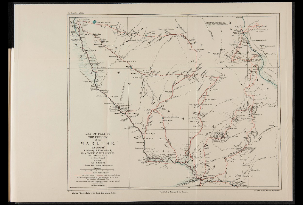
MA P OF P A R T OF
TH E KINGDOM
o f t h e
ï A R U T B E,
( b a - r o t s i ) ,
from Surveys & Explorations by
C a p t . ALFRED S'? HILL GIBBONS,
Mr. P E R C Y C. REID,
and Capt. Bertrand.
18 95-1896.
Scale^-l : 1,000,000.
S ta tu te M iles ( l Statute, Mile =1609 Mètres); : '.
Chîtÿj^
?,»2iW»aJnu3t°y 30I\
lifam ila n ja) ?
—*------- Capt. Gibbond Routes. 1 Mr. Reid’8 Route. * - - - - - - Capt. Bertrand’s Route.
A ll Latitudes determined by Capt. Gibbons and Mr. Reid
have been inserted upon the Map.
Information derived from previous Explorers has been placed
within brackets.
S Mission Stations.
<4u ^¿fLN&paaütS\JijLri
Reprinted by permission o f the Royal Geographical Society.
Published by Methuen é Co., London.
G .P h ilip S c -S a n ,,Z o n d /m ,S cZ v/e rp o dL .