±%0°Zi)rU/IT/rtml, 6'~h'
north, at a distance of six miles, should steer for the southern end of Oho-
sima, which can he seen, in this position, in clear weather. After passing
the southern end of Oho-sima, the navigator should steer west for the harbor.
No specific account is here given of the currents, which are rapid and
irregular throughout the G-ulf of Yedo. The only sure guides, therefore,
are the charts, the cross-bearings of the more prominent islands, and a good
look-out. Along this part of the coast, the influence of the stream, called
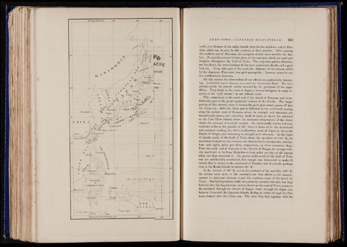
by the Japanese, Kuro-siwo, was quite perceptible. I t never ceases to run
in a northeasterly direction.
On this current the observations of our officers are particularly interesting.
A detailed report thereon, was made by Lieutenant Bent. We here
present merely the general results attained by the gentlemen of the expedition.
They found on the coast of Japan a stream analogous, in many respects,
to the “ gulf stream ” on our Atlantic coast.
This commences on the south end of the island of Formosa, and is undoubtedly
part of the great equatorial current of the Pacific. The larger
portion of this current, when it reaches the point just named, passes off into
the China sea; while the other part is deflected to the northward, passing
along the eastern coast of Formosa, where its strength and character are
unequivocally shown, and extending itself, at times, as far to the eastward
as the Lew Chew islands, where the increased temperature of the water
shows the presence of a torrid current. Its northwardly course, however,
continues as far as the parallel of 26°, when it bears off to the northward
and eastward, washing the whole southeastern coast of Japan as far as the
Straits of Sangar, and increasing in strength as it advances. At the chain
of islands south of the Gulf of Yedo, about the meridian of 140° E., its
maximum strength on one occasion was observed to be seventy-two, seventy-
four, and eighty miles per diem, respectively, on three successive days.
From the south end of Formosa to the Straits of Sangar, its average velocity
was found to be from thirty-five to forty miles per day, at all seasons-
when our ships traversed it. Its precise width south of the Gulf of Yedo
was not satisfactorily ascertained, but enough was discovered to make it-
certain that it reaches to the southward of Fatsicio, and it extends perhaps1
even to the Bonin Islands in latitude 26° N.
In the latitude of 40° N. and to the eastward of the meridian 143° E.
the stream turns more to the eastward, and thus allows a cold counter-
current to intervene between it and the southern coast of the island of-
Yesso. Our hydrographers .could not positively ascertain the fact, but they
believed that this hyperborean current, found on the coast of Yesso, passes to
the westward through the Straits of Sangar down through the Japan sea,
between Corea and the Japanese islands, finding an outlet through the Formosa
channel into the China sea. The data they had, together with the