M |
Date. Name of Country.
1876.
Ju ly 13 Marung
» i 13 »
„ 14 Ugu h a
Ï! I4
» I4, IS V)
I 5 ü i y iß.
», 15 yy
», 15 yy
» 15 -
■» 16, 19 yy
„ 20 yy
, 21 yy
, 22,. 23 Goma
24 yy _
24 ,, yy'
Name of Station, Village, or Caml liante
peen.
Katandala Point..
Mompara’s, or Para’s u.: .
Tembwe cape ................
Ruanda river
Muremba Point . ,
Kyyanda Head ..
Rutuku river
Mirembwe Point
Mouth of Lukuga Creek
/To Kiyanja ridge, and back
/ mouth of creek
Kahanga cape ................
North - west end of Kirindi Islai
Mdangâ Cape-
Kiringi cape
Rugufu river
R e m a r k s .
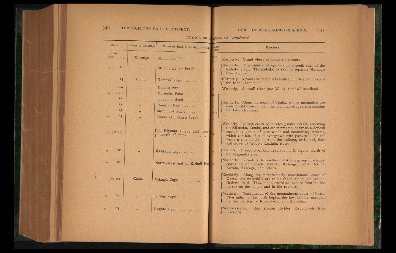
Northerly. Grand views of mountain scenery.
fNortherly. This chief’s village is situate south side of the
< Rubuko river. The Rubuko is said to separate Marungu
1 from Uguha.
/Northerly. A romantic cape; a beautiful little headland enters
\ the broad headland.
Westerly. A small river just W. of Tembwe headland.
Northerly. Along the coast of Uguha, whose mountains are
considerably lower than the mountain-ridges surrounding
the lake elsewhere.
Westerly. Lukuga creek penetrates 3 miles inland, receiving
the Kibamba, Lumba, and other streams, as far as a deposit
caused by action of lake winds and conflowing streams,
\ which consists of mud overgrown with papyrus. On the
western side of this barrier, the Lukuga, or Luindi, rises
I and flows to Webb’s Lualaba river.
/Easterly. A saddle-backed headland in N. Uguha, north of
\ the Rugumba river.
/Northerly. Kirindi is the southernmost of a group of islands,
c consisting of Kirindi, Kivizzi, Kasenge, Ikala, Mrima,
/ Kavala, Katenga, and others.
Northerly. Along the picturesquely mountainous coast of
Goma. Six waterfalls are to be found along this stretch.
Natives timid. They make enormous canoes from the fine
timber on the slopes and in the ravines.
/Northerly. Continuation of the mountainous coast of Goma.
. Five miles to the north begins the low isthmus occupied
/ by the districts of Kavunvweh and Karamba.
/North-easterly. This stream divides Kavunvweh from
\ Karamba.