l a n c e
w e e n .
R em a r k s .
| y , a n d R e t u r n t o N t e w i , U g a n d a .
lie s .
12
7
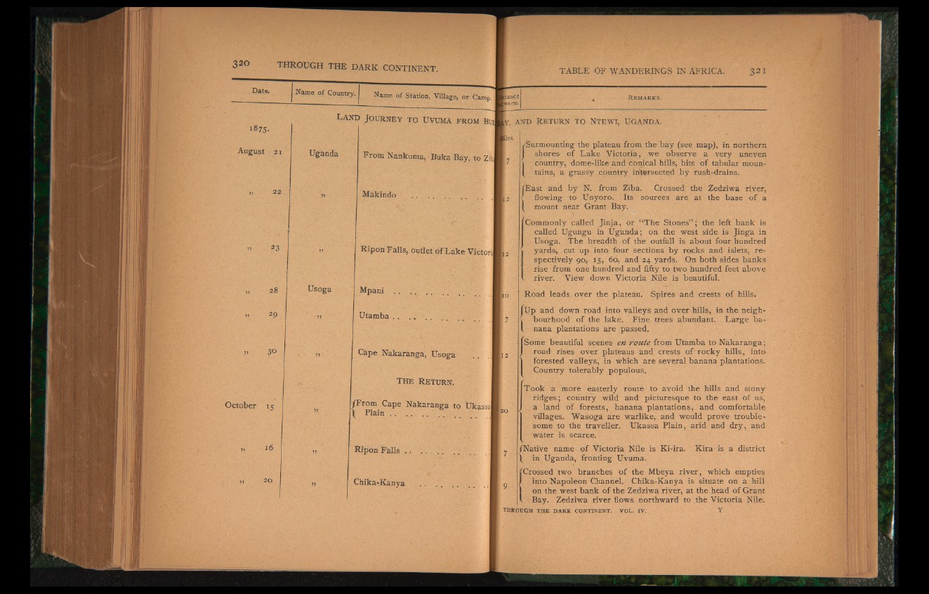
(Surmounting the plateau from the bay (see map), in northern
shores of Lake Victoria, we observe a very uneven
I country, dome-like and conical hills, bits of tabular mountains,
a grassy country intersected by rush-drains.
iEast and by N. from Ziba. Crossed the Zedziwa river,
flowing to Unyoro. Its sources are at the base of a
[ mount near Grant Bay.
Commonly called Jinja, or “The Stones” ; the left bank is
called Ugungu in Uganda; on the west side is Jinga in
Usoga. The breadth of the outfall is about four hundred
yards, cut up into four sections by rocks and islets, respectively
90, 15, 60, and 24 yards. On both sides banks
rise from one hundred and fifty to two hundred feet above 3 river. View down Victoria Nile is beautiful.
Road leads over the plateau. Spires and crests of hills.
I Up and down road into valleys and over hills, in the neigh-
■ bourhood of the lake. Fine trees abundant. Large ba-
. nana plantations are passed.
Some beautiful scenes en route from Utamba to Nakaranga;
road rises over plateaus and crests of rocky hills, into
forested valleys, in which are several banana plantations.
Country tolerably populous.
Took a more easterly route to avoid the hills and stony
ridges ; country wild and picturesque to the east of us,
a land of forests, banana plantations, and comfortable
villages. Wasoga are warlike, and would prove troublesome
to the traveller. Ukassa Plain, arid and dry, and
water is scarce.
/Native name of Victoria Nile is Ki-ira.
in Uganda, fronting Uvuma.
Kira is a district
(Crossed two branches of the Mbeya river, which empties
into Napoleon Channel. Chika-Kanya is situate on a hill
on the west bank of the Zedziwa river, at the head of Grant
Bay. Zedziwa river flows northward to the Victoria Nile.
th ro u gh t h e d a r k c o n t in en t , v o l . i v . Y