variation is two points, eafterly, and the tide rifes and falls
between four and five feet. We anchored here the 15th of
March, and left the place the next day.
XII. U P R IG H T BAY. This bay may be fafely entered,
as there is no Obftrudtion but what is above water. The
wood here is very fmalj, but we found fufficient to keep up
our ftpek. The water is excellent, and in great plenty. As
to provifions, we got only a few wild fowl, rock-fiflies, and
inufcles. The landing is bad. The latitude of this place is
53° 8' S. longitude 75° 37' W .; the variation two points eaft-.
erly. The water rifes and falls about five feet, but the tide
or current is very irregular. We anchored here on the 18th
of March, and failed again on the ,10th of April.
There are three very good bays a little beyond Cape Shut-
up, which we called R iver b a y , Lodging b a y , and W al-
eis’s b a y .’ Wallis’s bay is the beft.
About half way between Elizabeth’s bay and York road,
lies Mufcle bay, where there is very good anchorage with a
wefterly wind. There is alfo a bay, with good anchorage,
oppofite to York road, and another to the eaftward o f Cape
Crofs-tide, but this will hold only a fingle fhip. Between
Cape Crofs and Saint David's Head, lies Saint David’s Sound,
on the fouth fide o f which we found a bank o f coarfe fand
and Ihells, with a depth o f water from 19 to 30 fathom,
where a fliip might anchor in cafe o f necefiity; and the
Mailer of the Swallow found a very good fmall bay a little to
the eaftward o f Saint David’s Head. A little to the eaftward
of Cape Quod, lies Ifland bay, where the Swallow lay fome
time, but it is by no means an eligible fituation. The ground
o f Chance bay is very rocky and uneven, and for that reafon
Ihould be avoided.
As
As all the violent gales by which we fufFered in this navigation,
blew front the weftwstfd, it is proper to ftand about
a hundred leagues or more toi the weftward, after failing
out o f the Streight, that the lhi|p may’ hot be endangered on
a lee fhore, which at prefent is wholly unknown.
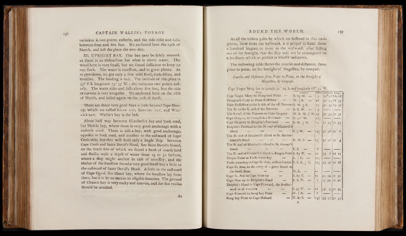
The following table fhews the cour-fes and diftances, from
point to point, in the Streight of Magellan, by compafs.
-- Courfes and Difiances from P oint to Point, in the Streight of
Magellan, by Compafs,
Cape Virgin Mary lies in latitude £ 2 ° 2 4 S'. and longitude63a 2 2 W.
From Courfes. Miles (Latitude1 r.o”E. Cape Virgin Mary'to Dungenefe Point — S. by 'W. — 5 S2f28 .68 >2 8 '
Dungenefs Point to Point Poffeffion — W — 18 SH'23 68 57 Point Poffeffion to the S. fide of the iff Narrows S. W. A S. 27 5.2 ^35 6 9 38 The N. to the S. end of the Narrows |£9 i s. s. w. The S. end of the Narrows to Cape Gregory 9 w . s. w. ; w. ■ 2$ 5.2 39 2° 31 (Jape Gregory to Sweepitak.es. Foreland *— S'. 3 0 ° w. 124
Cape Gregory to Dolphin's Foreland ■=— S; W. w. 14 52 43 7° 53 Dolphin’s Foreland to the N. end of Elizabeth’s
ifland — — — S. 1 w. — 144 52 71 6
The N. end of Elizabeth's ifland to St. Bartholomew’s
ifland — — — E. N. E. — Iw 52 "56 71 4 The N. end of Elizabeth's ifland to St George’s
ifland1 — — — S. E. —
The N. end. of Elizabeth’s ifland to Porpus Point s. byW. — 12 53 6 71 H Porpus Point to Frelh-water bay — S. 4 E. — ±2t Freih-waterbay to Cape St. Ann, or Port Famine Sv S. E.. jj E. 53 42 7l 28
Cape St. Ann, to. the entry of a great found on
the fouth. fhore — — N E. — —
Cape St. Ann to Cape Shut-up — s. by E. — 12 53 54 71 32 Cape. Shut-up to Dolphin’s ifland — S. s. w. — 7 53 59 71 4' Dolphin’s ifland to Cape Froward,, the fouthermod
in all America — — S.47W. - II 54 3 î7 59
Cape Froward to Snug bay Point — w N. — 8
Snug bay Point to Cape Holland — w by S. — 1 3r 53 57 | | 34
a.