Variation of the
compass.
Between Napakiang and the Sugar Loaf there is no
place for ships to lie in safety, the bay immediately to the
north was examined by Mr. Mayne, master of his Majesty’s
ship Alceste, when two shallow harbours were found.
The flood runs to the northward and eastward, along
shore, and the ebb in an opposite direction. The rise and
fall is about nine feet perpendicular. High water at full and
change IX.
The variation of the compass, determined with great
precision by the transit azimuth instrument, was 52'
westerly.
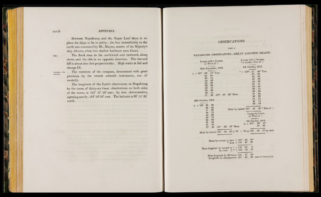
The longitude of the Lyra’s observatory a t Napakiang
by the mean of thirty-six lunar observations on both sides
of the moon, is 127° 37' 28" east; by four chronometers,
agreeing nearly, 127° 38' 30" east. The latitude is 26° 13’ 39'
north.
OBSERVATIONS
NAPAKIANG OBSERVATORY, GREAT LOO-CHOO ISLAND.
Lunars with a Sextant.
‘ ©' West of ' i
25th September, 1816.
© i 127° . 88' . 15" East.
35 . 15
36 . 15
34 . 45
33 . 00
86 . 00
80 . 45
28 . 30
32 . 15
31 . 30 127°
26th October, 1816.
3 3 '. 39" Mean
© i 127 . 88 . 80
39 . 45
41 . 30
44 . 15
44 . 80
32 . 15
33 . 00
31 . 45
31 . 15
27 30 127° . 3 6 '. 16" Mean
Lunars with a Sextant.
* a Arietis, East of Î
4th October, 1816.
* î 127' . 3 1 '. 00" East.
.87 . 00
43 . 00
52 . 30
54 . 30
38 . 45
52 . 45
50 . 15
50 . 30
41 . 45
40 . 30
34 . 15
43 . 15
39 . 45
Mean by sextant 127 . 43 . 20 * East of
Lunars by Circle.
O West of d
4th October, 1816.
O d 1^7° • 3 8 '. 45"
32 . 30
Mean by sextant © west ï 127°. 34' . 58"
Mean longitude by sextant © * , 127 . 39 . 9
Mean longitude by 36 lunars 127 • 37 • 28 ..
Longitufe by chronometers 127 - 38 . 30 east of Greenwrch.