WESTERN TIBET
18,150 ft., and sometimes the Mangshan Pass, though
the latter is very difficult. The former leads to Gyanema
and the latter to Taklakot.
(10) The Byans apd Chaudans Bhotias use the Lipu
Lekh Pass, 16,780 ft., called by the Tibetans Jang
Lhaula, and also the Tinkar Pass in Nepal of the same
height. These lead to Taklakot.
(11) The Humlis use a pass in the extreme North-
Western corner of Nepal when they visit Taklakot.
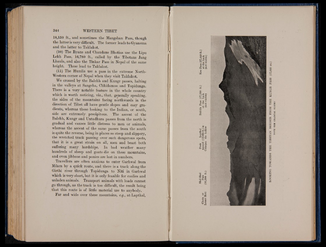
We crossed by the Balchh and Kungr passes, halting
in the valleys at' Sangcha, Chhidamoo and Topidunga.
There is a very notable feature in the whole country
which is worth noticing, viz., that, generally speaking,
the sides of the mountains facing northwards in the
direction of Tibet all have gentle slopes and easy gradients,
whereas those looking to the Indian, or south,
side aré extremely precipitous. The ascent of the
Balchh, Kungr and Untadhura passes from the north is
gradual and causes little distress to men or animals,
whereas the ascent of the same passes from the south
is quite the reverse, being in places so steep and slippery,
the wretched track passing over such dangerous spots,
that it is a great strain on all, men and beast both
suffering many hardships. In bad weather m a n y
hundreds of sheep and goats die on these mountains,
and even jibboos and ponies are lost in numbers.
Travellers are often anxious to enter Garhwal from
Milam by a quick route, and there is a track along the
Girthi river through Topidunga to Niti in Garhwal
which is very short, but it is only feasible for coolies and
unladen animals. Transport animals with loads cannot
go through, as the track is too difficult, the result being
that this route is of little material use to anybody.
Far and wide over these mountains, e.g., at Lapthal,
44 o T jl «O8 rrHO *P•—\ ©*3 CO r-d
CO
c S j j o
¡ u q . ii.
03 S3 +3
Ph +3 C2 ^ eg — 3
mm
Ji HaU I©
UU11
<- Ph
P3
O
&P
M
WM
m
H Ph od
O Ph
Ph fc>-
Q
Ph <
W P3
Q o
Ph
O W Eh
« S
EhO
H
W PQ
EH
H
WH
CQ ft
Ph
<1
O
H
Og
Ph
OOP