which, in its widest extension, consisted of the provinces
of Semirechia, Kuldja, Syr- and Amu-daria,
Ferghana, and Zarafshan. It is well to remember this,
because some of the best authors upon the country
wrote during this golden age, if I may so call it, and
in their mouths Russian Turkistan means this wide
extent of country which amounted to one-twentieth
part of the entire Russian Empire,* and exceeded in
area each of the other first-class states of Europe.
I shall constantly have to refer to “ Russian Turkistan
in this wider meaning, but it should be borne in mind
that Kuldja has been given back to the Chinese, an
Semirechia forms a portion of the general government
of the Steppe, so that the general government
of Turkistan now includes only the four provinces of
Syr-daria and Amu-daria, Ferghana, and Zarafshan.
Its greatest breadth along the 43rd parallel is 750
miles ; its length, on the 84th meridian, is 460 miles ;
the entire area of the vice-royalty being 257,000
square miles, or the extent of the Austrian Empire
and Switzerland. It is bounded on the north by the
of the Tarbagatai range. To this was added in the
Zarafshan circle with the town of Samarkand, then in 7
district with the town of K u ld ja ; the Amu-daria section m 1873 ; and
lastly, in 1876, the Khanate of Khokand was annexed thereto, and
renamed as the province of Ferghana.
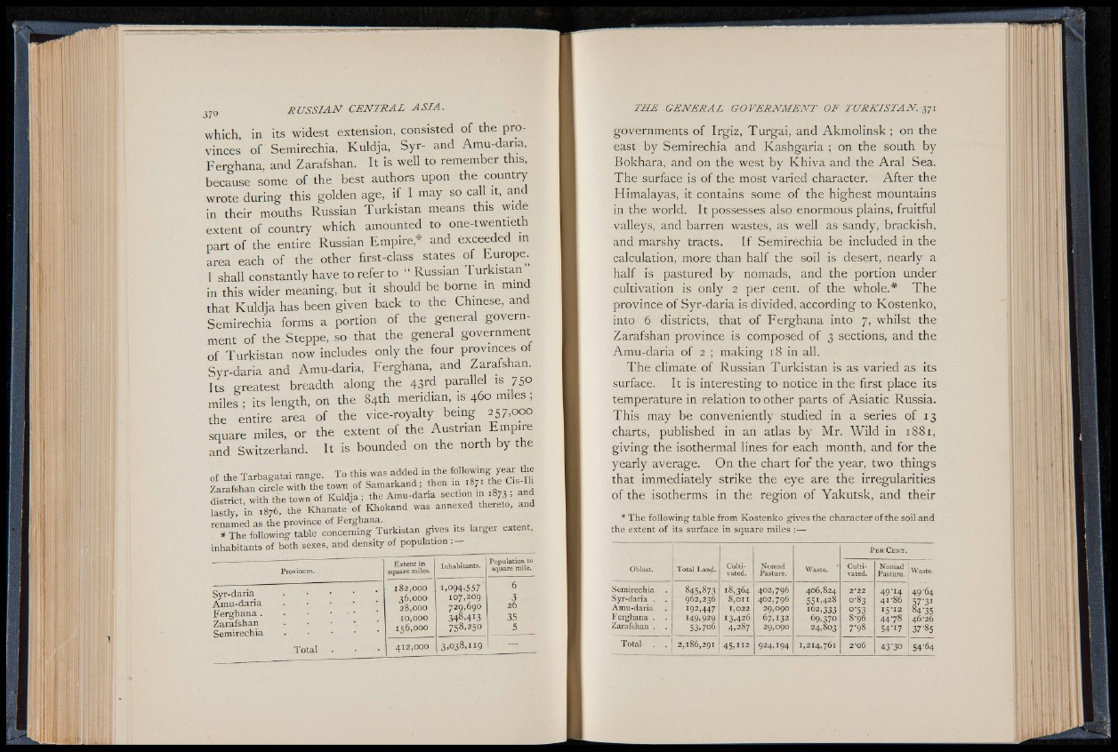
* The following table concerning Turkistan gives its larger extent,
inhabitants of both sexes, and density of population :
Provinces.
Extent in
square miles.
Inhabitants.
Population to
square mile.
Syr-daria
Amu-daria
Ferghana .
Zarafshan
Semirechia
182,000
36.000
28.000
10.000
156,000
1,094.557
107,209
729,690
348,4I3
758,25°
63
26
35
5
Total 412,000 3 ,0 3 8 , 1 1 9 ___________
governments of Irgiz, Turgai, and Akmolinsk ; on the
east by Semirechia and Kashgaria ; on the south by
Bokhara, and on the west by Khiva and the Aral Sea.
The surface is of the most varied character. After the
Himalayas, it contains some of the highest mountains
in the world. It possesses also enormous plains, fruitful
valleys, and barren wastes, as well as sandy, brackish,
and marshy tracts. If Semirechia be included in the
calculation, more than half the soil is desert, nearly a
half is pastured by nomads, and the portion under
cultivation is only 2 per cent, of the whole.* The
province of Syr-daria is divided, according to Kostenko,
into 6 districts, that of Ferghana into 7, whilst the
Zarafshan province is composed of 3 sections, and the
Amu-daria of 2 ; making 18 in all.
The climate of Russian Turkistan is as varied as its
surface. It is interesting to notice in the first place its
temperature in relation to other parts of Asiatic Russia.
This may be conveniently studied in a series of 13
charts, published in an atlas by Mr. Wild in 1881,
giving the isothermal lines for each month, and for the
yearly average. On the chart for the year, two things
that immediately strike the eye are the irregularities
of the isotherms in the region of Yakutsk, and their
* The following table from Kostenko gives the character of the soil and
the extent of its surface in square miles :||||||
P e r C e n t .
Oblast. Total Land. Cultivated.
Nomad
Pasture. Waste. Cultivated.
Nomad .
Pasture. Waste-
Semirechia
Syr-daria . .
Amu-daria
Ferghana . -
Zarafshan .
845,873
962,236
192,447
149,929
53,706
18,364
8,011
1,022
13,426
4,287
402.796
402.796
29.090
67,132
29.090
406,824
551,428
162,333
69,370
24,803
2*22
0-83
0-53
8-96
7-98
49-14 49-64
41-86 57-31
!5 'I2 84-35
4 478 46-26
54'17 1 37'85
Total . . 2,186,291 45, u 2 924,194 1,214,761 2*06 43'3° 1 54'64