near a pool of water, and in the morning discovered that I was
in the middle of the town graveyard, and the pool we had been
drinking from was where the people washed themselves and
their clothes! This had been a very fatiguing march, and I
had had nothing to eat but a few biscuits since leaving Golbanti
at 6 a.m.
The thermometer at Kau next day (February 21) at 6 and
10 a.m., 12 noon, and 2 p.m., stood respectively at 70°, 86°, 87°,
and 87° in the shade.
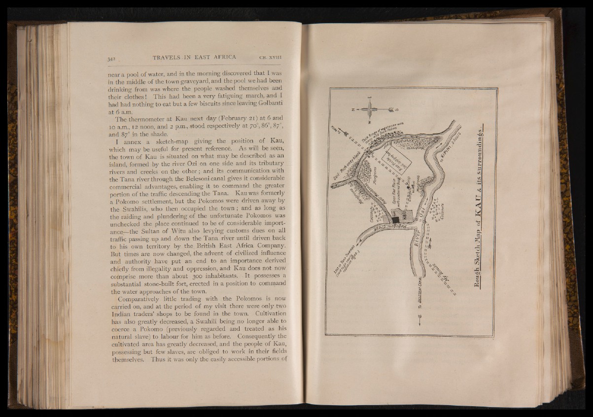
I annex a sketch-map giving the position of Kau,
which may be useful for present reference. As will be seen,
the town of Kau is situated on what may be described as an
island, formed by the river Ozi on one side and its tributary
rivers and creeks on the other ; and its communication, with
the Tana river through the Belesoni canal gives it considerable
commercial advantages, enabling it to command the greater
portion of the traffic descending the Tana. Kau was formerly
a Pokomo settlement, but the Pokomos were driven away by
the Swahilis, who then occupied the town; and as long as
the raiding and plundering of the unfortunate Pokomos was
unchecked the place continued to be of considerable importance—
the Sultan of Witu also levying customs dues on all
traffic passing up and down the Tana river until driven back
to his own territory by the. British East Africa Company.
But times are now changed, the advent of civilized influence
and authority have put an end to an importance derived
chiefly from illegality and oppression, and Kau does not now
comprise more than about 300 inhabitants. It possesses a
substantial stone-built fort, erected in a position to command
the water approaches of the town.
Comparatively little trading with the Pokomos is now
carried on, and at the period of my visit there were only two
Indian traders’ shops to be found in the town. Cultivation
has also greatly decreased, a Swahili being no longer able to
coerce a Pokomo (previously regarded and treated as his
natural slave) to labour for him as before. Consequently the
cultivated area has greatly decreased, and the people of Kau,
possessing but few slaves, are obliged to work in their fields
themselves. Thus it was only the easily accessible portions of
Rough Sketch Map of K A T J & its s u r r o u n d i n g