r il:
Mi
' -i I
■1
= 'i
J
tlie temperature falls steadily and perceptibly to the
bottom, and tb a t tbe bottom temperatnre is more
tban 2° C. loAA'er tban tbe temperature at similar
depths in tbe eastern or tbe nortb-western basin.
Tbe conditions AA'bicb exist at the mouth of the
troug'h extend to the equator.
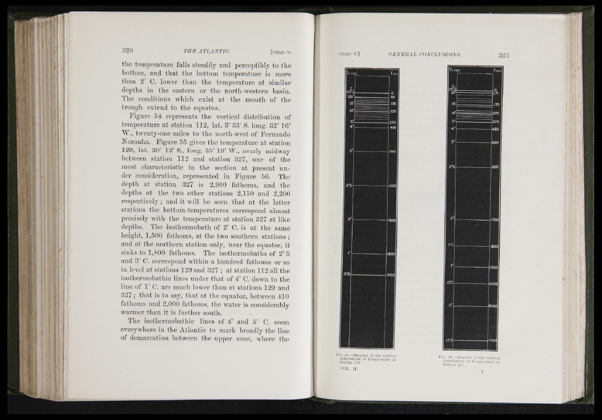
Ligure 54 represents the vertical distribntion of
temperatnre a t station 112, lat. 3° 33' S. long. 32° i 6'
W., tAventy-one miles to tbe nortb-Avest of Fernando
Noronha. Figure 55 giv^es the temperature at station
129, lat. 20° 12' S., long. 35° 19' W., nearly midAvay
betAA'een station 112 and station 327, one of the
most characteristic in the section at present under
consideration, represented in Figure 56. The
depth at station 327 is 2,900 fathoms, and the
depths at the tAvo other stations 2,150 and 2,200
respectively ; and it Avill be seen tb a t a t tbe latter
stations tbe bottom-temperatnres correspond almost
precisely Avith the temperatnre at station 327 at like
depths. The isothermobath of 2° C. is at the same
height, 1,500 fathoms, at the trro southern stations ;
and at the northern station only, near the equator, it
sinks to 1,800 fathoms. The isothermohaths of 2°’5
and 3° C. correspond Avithin a hundred fathoms or so
in level at stations 129 and 327 ; at station 112 all tbe
isotbermobathic lines under tb at of 4° C. doAvn to tbe
line of 1° C. are much lower than at stations 129 and
3 2 7 ; th a t is to say, th a t at the equator, between 410
fathoms and 2,000 fathoms, the water is considerably
AA'armer tban it is further soutb.
Tbe isotbermobatbic lines of 4° and 5° C. seem
everyAvbere in tbe Atlantic to mark broadly the line
of demarcation between tbe upper zone, where the
I'Ki. .>3.—Dia^ivaia ol’ the vertíc-al
iHstribution of TeDioeraliii'e at
sta tio n 129.
— Dia.nrain o f the v o r lic a l
« li.s írilu itio ii ol T c iiijK T a U u c al
S ta tio n 327.