Distan STATIONS
T h e rm om e te r
in the Shade.
1811.
1 g 1
¡ J o I
'S) §
t ì s
irVitli their Latitudes, calculated from
Astronomical Observations made on
the Journey : to which are added their
English names and intermediate Distances.
Time of
Observation.
-1J J.1
« 1
WEATHER.
H. M. H. M.
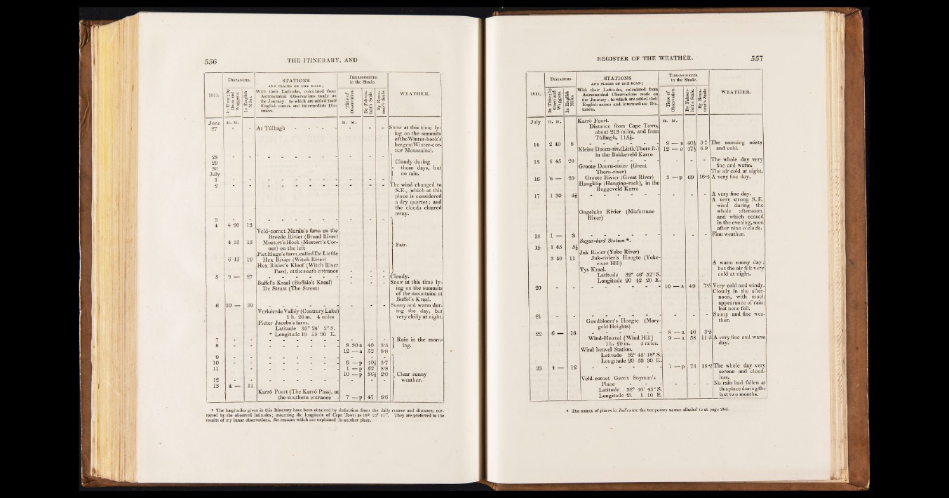
At Tu lb a g li - - * - Snow at this time lying
on the summits
oftheWintcr-hoek’s
bergen(Winter-cor-
ner Mountains).
28
29
SO
July
I Cloudy duiing
? these days, but
I no rain.
2 The wind changed to
S.E., which at this
place is considered
a dry quarter; and
the clouds cleared
34
4 20
4 35
6 15
IS
15
19
Veld-cornet Marius’s farm on the
Breede.Rivier (Broad River]
Mostert’s Hoek (Mostert’s. Corner)
on the left
PietHugo’s farm, called DeLiefde
Hex Rivier (Witch River)
Hex Rivier’s Kloof (Witch River
Pass), at the south entrance
away.
• Fair.
5 9 — 27
Bufiel’s Kraal (Buffalo's Kraal)
De Straat (The Street)
- -
Cloudy.
Snow at this time lying
on the summits
of the mountains at
BufFel's Kraal.
6 10 — 30
Verk6erde Valley (Contrary Lake
1 h. 20 m. 4 miles
Pieter Jacobs’s farm.
Latitude ‘ 33° 24' 2" S.
* Longitude 19 59 30 E.
Sunny and warm dur-
. ing the day, but
very chilly at night.
7 1 Rain in the morn-
8 8 30 a
12 — a
40
52
8-5
8-8
3 ing.
10
11 -
9 — p
1 - p
10 — p
40:
52
36$
3*7
8-8
2*0 Clear sunny
12
IS
1
4 — 11
Karro Poort (The Karro Pass), a
the southern entrance 7 - p 47 6-6
weather.
.
• The longitudes given in this Itinerary have been obtained by deduction from the daily course and distance, corrected
by the observed latitudes; assuming the longitude o f Cape Town as 18® 23' 11". They are preferred to the
results of my lunar observations, for reasons which are explained in another place.
Distances. STATIONS
AND PLACES ON THE ROAD ;
Thermometer
in die Shade.
1811.
In Time ; by
Oxen'and
Waggons.
I s e
Vitli their Latitudes, calculated from
Astronomical Observations made on
the Journey : to which are added their
English names and intermediate Distances.
Time of ■
Observation.
By Fahrenheit’s
Scale.
Û
pa aa
WEATHER.
July H. M. Carr6 Poort.
Distance from Cape-Town,
about 213 miles, and from
Tiilbagh, 115$.
H. M.
The morning misty
14 2 40 and cold. 8
Heine Doorn-riv.(LittleThorn R.)
in the Bokkeveld Karro
9 — a
12 — a
40$
47$
3*7
6.9
15 6 45 20
Groote Doorn-rivier (Great
Thorn-river)
"
'
The whole day very
fine and warm.
The air cold at night.
16 '6 — 20 Groote Rivier (Great River)
Hangklip (Hanging-rock), in the
Roggeveld Karro
3 - p 69 16*4 A very fine day.
17 1 30 4-$
Ongeluks Rivier (Misfortune
River)
A very fine day.
A very strong S. E.
wind during the
whole afternoon,
and which ceased
in the evening, soon
after nine o'clock.
18
19
1 —
1 45
3 40
3
5$
11
Sugar-bird Station *.
Juk Rivier (Yoke River)
Juk-rivier’s Hoogte (Yoke-
river Hill)
Tys Kraal.
Latitude 32° 46' 52" S
Longitude 20 42 20 E
Fine weather.
A warm sunny day;
but the air felt very
cold at night.
10 — a 49 7*5 Very cold and windy.
Cloudy in the afternoon,
with much
appearance of rain;
but none fell.
21 ” ■ Goudbloem’s Hoogte (Mary
gold Heights)
Sunny and fine weather.
22 6 — 18
Wind-Heuvel (Wind Hill)
1 h. 20 mr 4 miles.
Wind lieuvel Station.
Latitude 32° 45'18" S
Longitude 20 53 30 E
•8 — a
9 — a
40
58
3*5
11*5 A very fine and warm
dayi
23 4 — 12
Veld-cornet Gerrit Snyman’s
Place
Latitude 32° 46' 45" S
Longitude 21 1 10 E
1 — p 73 18-5 The whole day very
serene and cloudless.
No rain had fallen at
this place during the
last two months.
• The namca of places m Italics are the tcntpotary names alluded to at page 286.