k
S'îli:
A T L A S OF AUSTRALIA—1S86.
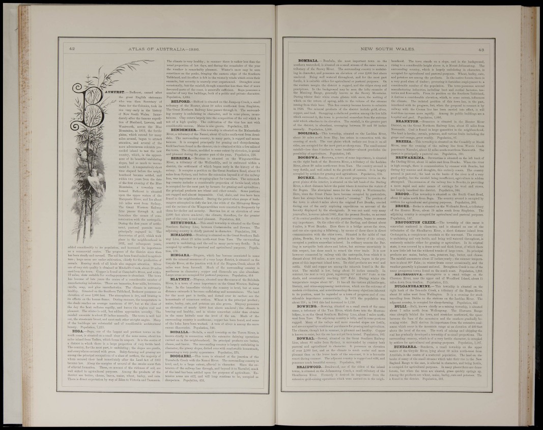
ATHTTRST.—Bftthiirst, naaed after
tlie grant BnglUli statesman
who was then Sacretaiy of
State for the Colouies, took its
rise very eai'ly in the liistory
of Now South Wales. Immediately
after the famous expedition
of Blaskud, Lawson, iiud
Went worth, across the Blue
Mountains, in 1813, the fertile
plains, wliich extend for many
miles around, began to atti-aet
attention, and several of the
ceeded inland to test the
ance of its beautiful undulating
slopes, had so much to recommend
it. A comparatively short
time elapsed before the neighbourhood
became settled, and
within two years from the dato
g of t^ I Blue
Mountains, a
foraed. Hathu
situated
npon the npper
acq u ario Eítci
1+5 miles wast
The Gi^eat Western EaOi
Line passes through it, and
furnishes the means of communication
^vith the metropob's.
" Duriug the first years of settlement,
pastoral pursuits were
principally engaged in. The
discoveries of gold, wliich took
place in the ueighbonrhood in
1S51, and subsequunt years,
0 its population, and increased its importauco
itre. The progress of the district since then
nwai'd. Thosoilhasbeenfonndsuitedtoagriculunder
cnltivation, chiefly for the production of
added considerably t'
as a ccmmei-cial cet
has been steady and o.
i terge:
cercáis. Rearing stock of all kinds also engages attention. Silver
oro of very rich (jnality is obtained at Mitchcll's Creek, about 20 miles
east from the town. Copper is found at Campbell's Hirer, and ivithiu
13 miles, slate suitable for roofing-purposes is abundant. The town
has become of late years the centre of a considerable number of
raBDufac-turing industrie.«., There are tanneries. Hour-mills, breweries,
candle, soap, and glue manufactories. The climate is extremely
healthy. Situated on the Southern Tableland, Bathurst possesses au
elevation of over 2,000 feet. The atmosphere is dry, and bracing in
its effects on the human frame. During smnmer, the temperature in
the shade reaches an average maximum of 88°, but at the close of
the day the heat radiates rapidly, and leaves the nights cool and
pleasant. The wnter is cold, but seldom approaches severity, Tiio
rainfall amounts to about 25 inches annually. The town is ;vell Inid
out, the streets are broad, and meet each other at right angles. Many
of the buildings are substantial and of considerable architeotiii-al
beauty. Populatioi
e of the Inrgast and prettiest towns on the
south coast, is situated on a small rivei' of the same name, about ten
mites inland from 'Cathrn, which forms its seaport. It is the centre of
a district in ^^hich there is a largo proportion of very fertile land.
The country, for the most part, is undulating; the slopes are goutlo,
and everywhere covered with grass. Daiiy-farming and grazing are
among the principal occupations of a class of settlers, the majority of
whom secured their land inunedifttely after the Laud Act of 1861
became law. AJoug tho margins of several of the creeks occur fiats
of alluvial formation. These, on account of the richness of soil, are
well suitod to agricultural purposes. Among the products of the
district are butter, cheesc, bacon, maize, wheat, barley, and oats.
There is direct expoi'tation by way of Edon to Victoria aud Tasmania.
The climate is very healthy ; in summer there is nither less than tho
usual proportion of hot days, and durijig the reu>ainder of the year
the weather is remai-kably pleasant. Winter's snow may be seen
sometimes on the peaks, fringing the eastern edge of the Southeni
Tableland, and its efiect is felt in the westerly winds wHch ci'oss their
summits, but severity is scai-eely ever experienced. Droughts occuioccasionally,
but the rainfall, though somewhat less than that of more
favoured parts of tho const, is generally
number of very fine buildings, both of a public and pi-iv?
Population, 1,034,
BELPORD.—KH
1 is situated on the Jiimp-up Creek, a small
ibout 10 miles south-east from Singleton,
ay Ling passes through it. The surronndthe
ti-ibutai-y of tho Hunti
The Great Northern Raihva
ing count.T is undulating i
tainous. Clay enters largel;
not of a high quality. Tb
considerable success. Maiz.
composition of the soil which is
tivation of the vine has met mth
so gi'own. Population, 221.
,—Tlii.-c township is situated on the Muluerindis
Hiver, a tribiitaiy of the Namoi, about 4.5 miles south-west from Armidale.
The sni-roiuiding country, in many parts, is rugged aud mountainous.
It is occupied principally for grazing and sheep-farming.
Gold has been found in the dUtrict; tin is obtained within a few miles of
the town. The climate, modified to some extent by elevation, is genial
aud pleasant din-ing the {rreater part of the year. Population, 220.
BERRIMA.-liorriu.:, is situated ou tho Wingecan-ibbee
Rivei-, a tributary of the Wollondilly, and is embraced within a
district, the .settlement of which began early in the history of the
colony. It occupies a position ou the Gi-eat Southern Eoad, about 83
miles from Sydney, and before the extension beyond it of the railway
line, was important as a stopping-place for travellei-s. The sui'ronudiug
country includes a considerable proportion of fertile land, which
is occupied for tho most part by farmers for grazing and agriculture;
the principal products are wheat and other cereals. Some portions
are i-ugged and almost impassable. Coal, shale, aud iron have been
found in the noighbourhood. Duriug thu- period when gangs of bushrangei
s attempted to dofy the law, the wilds of the Mittagong Range
and the ra^-ines of the Wingecarribbee were resorted to frequently by
them for shelter aud security. Ben-inia lies at an elevation of over
2,000 feet above sea-level; the climate, therefore, for the greater
part of the year, is cool aud pleasant. Population, 444.
BETHUNG-RA.—This small township is situated on the Great
Southern Railway Line, between Coot-amuudra aud Jownee. The
adjoining country is chiefly pastoi-al in character. Population, 104.
BlNALOlTCr.—Biualong is situated on the Great Southern Railway
Liue, about 21 miles north-west from Tass. The suri'onuding
country is undulating, and the soil in many parts very fertile. It is
occupied by settlers for pastoral and agi'icultural purposes. Popula-
BING-ARA.—Bingara, which has become associated in name
with the mineral resources of a voiy large district, is situated on the
Gwydii- River, at the junction with it of tho IJiugara Creek, about 3-5
miles west from luverell. Much of the surroimdiug country is
auriferous in character; copper and diamonds are also abundant.
Large areas are occupied for pastoral purposes. Population, -l-l-l
B L A T N E Y.—Blayney, situated near the source of the Bolubula
River, is a to\vn of some importance on the Great Westeru Railway
Line. In the immediate vicinity the c
distance ouhvards it becomes undulating and r.
for the most part is fertile, and dotted o^
homesteads of numei-ous settlers. Wheat is
maize, barley, oats, aud potatoes are also groan
elevation of nearly 3,000 feet above se:
bracing aud healthy, and in mnter somewh
Bli
-level
vel, but at some
¡nous. The land
surface are the
cipal product;
yuey possesses
•Xie climate is
I the ititude • the I of tho
auiTounding country is auriferous; copper has bei
of the lodes have been worlced. A vein of silver
recent discoveries. Population, 720.
BODALLA.—Bodalla, a small township ou the Tuv
known chiefly in connection with the oxten;
carried on in the neighbourhood. Its
colder than obta
Jliioh of
found, aud so
among the ni'
, and b The:
s prm.
iraoter, the grassy slopes,
presenting a very pretty a))]
;edo
dairjaug operations
products are butter,
ato-is large
with comfort!
ble homesteadi
Population, 37.5,
BOGGABK.I.—This town is situated at the junction .
if the
Tiirrabcilo Creek with the Namoi Biver. Tho surrounding coui
level, and, to a large extent, alluvial in character. Since tl
tension of the railway line through, and beyond it to Narrabri,
of the land has been settled upon for purposes of agriculture. 1
tensive areas are still, and ivill long continue to bo, occupied
sheep-runs. Population, 4.53.
lueh
N E W SOUTH WALES.
BOMBALA. — Bouibala, thu • most importar it to>vn on the
southern watershed, is situated ou a small stream of the same name, a
tributary of the Suowy River. Th e surrounding CO •untry is uudulating
in character, aud possesses au e levatiou of over 2,000 fe et above
sea-level. Being well watered thi• oughout, aud f)cr the m est part
fertile, it Ls suitable either for agric ultiiral or pastori CS. On
the western margin the district is rugged, and the ridges steep ai
precipitous. Li tho background may be seen the lofty summits
the Muuioug Range, generally known as the Snowy Mouiitaii
During winter their white ci-esta glisten «-ith snow, the malting
which on the return of spring, adds to the volume of the streni
issuing from theii' base. This fine country became known to oolonis
in 1823. The mineral products of tho disb-ict include gold, silvi
copper, and lead. Occupj-ing a sheltered position among tho low hi
which surround it, tho town is protected some>«'hac from the exti-ui;
cold which attaches to its elevation. The rainfall, in the great
of the district, is abimdaut, averaging between 30 and 50
annuaUy, Population, 1,000.
n- part
BOOIIGAI..—This township, situated on the Lachlau River,
about 50 miles north from Hay, has arisen in connoction with the
crossing of stock. The vast plains which radiate out from it on all
sides, are occupied for the most part as sheep-runs. The small omiual
rainfall—less than 8 inches in some localities—almost precludes the
possibility oí agriculture. Population, 145,
BOOROWA.—Boorowa, a town of some importance, is situated
on the right bank of the Boorowa Rivor, a tributary of the Lachlan
River, about 38 miles north-west from Yass. The couutiy around is
very fertile, aud well suited to the gi'owth of cereals, It is lai'gely
occupied by settlers for grazing and agriculture. Po]julatioD, ().58.
BOURSE.—Hi.in-kc. one of the most prosperous towns on the
great plains of the interior, is situated on the left bauk of the Darling
River, a short distance below the point where it receives the waters of
the Bogau. The aboriginal name for the locality is Wurtiemurtie.
Hero, since tho Great Plains have becomc occupicd by pastoralista,
there has always been what is termed a "crossing." The position of
the town is about ü miles above the original Fort Boui-ko, erected
duiing one of the early exploring expeditions on account of the
ferocity displayed by the aboriginals. It was not until very many
years after, however (about 18(53), that the present Bourke, on account
of its central position iji the strictly pastoral countiy, began to assume
any importance. Ou the other side of the Dai-ling, and distant about
S miles, is "W'est Boui-ke. Here there is a bridge across tho river,
aud one also spanuiug a billabong; by means of these there is direct
communication Avith the older tomi. Situated in tho midst of vast
plains, Bourke, for a voi-y long period in the history of the colon;
bourhood. The to>vn stands on a slope, and in the backgi'ound,
rising to a considerable height above it, is Mount Jollanuitong. Tho
surrounding countiy, which is largely undulating in character, is
occupied for agricultui'nl and ])astoral purposes. Wheat, barley, oats,
and potatoes ai-e among the products. In tho native forests there is
a very good c!a-ss of timber; procuring it furnishes employment to a
considerable number of the population. Tlie town possesses several
manufacturing industries, including boot and cordial factories, tanneries
and fioui'-mills. I'rom its position On the Southern Tableland,
it derives a considerable elevation, which, to some exteot, iniluences
the climate. The isolated position of this town lias, in the past,
interfered with its pi-ogress, but, when the proposal to connect it by
railway with the Cooma liue has been carried into effect, it vrill
doabtless increase more rapidly. Amoug its public buildings are a
hospital and gaol. Population, 1,006.
BRANXTON Brauxton is situated in tho Huuter River
District, ou the Great Northern Railway Line, about 35 miles from
Newcastle. Coal is found in large ijuautities in
neighboui-hood.
The land is fei-tile; cereals, potatoes, and various
grape and orange, grow readUy, Population, 87.
BREEZA.—This township is situated on the Conodilly or Xfooki
River, uear the crossing of tho railway line from Wen-is Creek
junction to Narrabri, about 82 miles south-west from Tamworth. The
district is principally a pastoral one. Populatiou, 130.
BREWARRIM-A.—Brewarrina is situated
the left bank of
"\7hen the river
the Darling River, about 53 miles east fiom Bourki
Ls high enough, there is communication by steamer with Bourke, but
during dry seasons aud droughts, this entirely ceases. The country
around is pastoral; the land on the banks of the river is of a verjgood
quality, but the rainfall being iusuflicient, agriculture is seldom
attempted. The extension of tha railway Une to Bourke, in providing
ipid and safer m
has largely benefited this disi
BROÖO.—This townsh
of carriage for wool aud stores,
Poi 3-14.
isition somewhat
ling is navigable both above and below, but extreme unc
this respect, has done much to retard the river trade,
however connected by railway with the metropolis, from
distant about 503 miles; a new era has, therefore, begun
gress of this important inland town. Its chief products ai-i
cattle. Gold and copper are amoug the niiuerals found i
, the Dar-
Qty in
n the prowool
and
D disincbes
i
summer, the heat i
shade, and occasi
temperature r
literary, and c
iialiy.
ind 100° Fahr.
is low, beiug about lij
ery groat, registering 95'
:casionally reaching 120" Pahr. During winter the
inges about 52°. It has all the various philanthi-opic,
rime-suppressing institutious, which are the outcome of
ition, and notwithstanding tho manyobjectiousinierent
to its position, must be regarded as a to^vn of progi'oss and of considerable
importance comuiereially. In 1871 the population was
about 318 ; in 1881 this bad increased to 1,138.
BOWNIlTG.-lio,, ning, situated ou a small crook of the same
name, a tributary of the Yass River, which flows into the Murnimbidgee,
is on the Great Southern Railway Line, about 7 miles northwest
from Yiiss, Tho adjoining couutiy is hilly, and in some portions
rugged. JIauy of tho valleys and more rounded slopes
and aro occupicd by conditional purchasers for gi-aziiig aud.
Tho climate, though hot in summer, is pleasant and health
is known to exist, but the ore has not yet been tested. Po))!
BOWRAL.-ll.i".-iil, situated on the Gi'eat Southe
fertile.
Copper
n Railwi
Line, about 80 miles from Sydney, is surrounded by cc
pastoral and ftgriciiltural in character. It possesses a
elevation
of over 2,000 feet, and as the climate is much cooler aud more
pleasant than on the lower lands of the soa-coast. it is a favourite
resort during summer. The adjacent country is rugged and wild, and
possesses nmch beautiful scenery, Poj>ulation, 303.
BRAIDWOOD.—Uraidwood, one of the oldest of the inland
towns, is situated on the Jellamatoug Creek, a small ti'ibutary of the
Shoalhaveu River. Pormoriy it derived its importance fi-om the
extensive gold-miniug operations which were carried on in the neighc
ted on the South Coast Road,
about 10 miles north from Bega. The couutiy around is occupied by
settlers for agricultural and graziug pui-poses. Population, 203,
BROKE.-Hr.,kc is situated on the Wollombi Brook, a tributary
of the Hunter River, about 15 miles south from Singleton. The
adjoining country is occupied for agricultural and pastoral purposes.
Population, 1G7.
BROtTG-HTON CREEK.—The township of this uame is
somewhat scattered in character, and is situated on one of the
tributaries of the Shoalhaven Biver, a short distance iulaud from
Coolaugatta, a conspicnous mountain on the sea-coast. The country
is undulating aud very fertile, aud being well watered throughout, is
eminently suitable either for grazing or agriculture. In its original
state, it was covered by a dense scrub and thick forest, of which there
is now Uttle left but the «-ithered trunks of large trees. Its princi])al
products aro maize, barley, oats, potatoes, hay, butter, aud cheese.
Tha rainfall amounts to about 27 inches yearly; the summer temperature
is about 80° Fahr,; in wiuter fi-osts occur occasionally, and the
weather generally is pleasant and cool, Bronghton Creek is one of the
many prosperous towns found on the south coast. Population, 1,288.
BRXrSHG-ROV£.—Brushgrove is a small \-illage on tho
Clarence Biver, uear the upper end of Woodford Island, about 1.5
mites dovni from Grafton. Population, 115.
BULGANDBAMllTE.-This township is situated on the
I'lght bank of tho Ten-mile Creek, a tributary of the Bogau Biver,
about 50 miles west from Wellington, It, is a crossing for stock
travelling from Dabbo to the stations on the Lachlan Biver. The
adjacent country, is occupied for sheej>-farming. Population, 4-12.
BUILI.—Biilli, known chiefly as a mining township, is situated
about 7 miles north from WoUongong. The lUawarra Range
rises abruptly behind tho town, and stretches southward, the space
between the base of the mountains and the seashore graduallv becomiug
wider, Bulli derives its impoi'tance from the extensive coalwWci
u-in intain v nge a .£ 400 h
k of mining and slii])ping the
abov^e the level of the sea.
coal has gradually developed a
jwnship of no small p
surrounding country, wliioh is of a very fertile character, is occupied
by settlers for agricultural and graziug purposes. Populatiou, 1,187.
BtTNDARRA.-Bimdarra, a small towuship on the upper
watei-s of the Gwydir River, lying about 60 miles north-west from
Armidale, is the centre of a scattered population. The land on the
banks of many of the small streams which take thoir rise in the New
England Range to the east, is alluv-ial in character, and being fertile,
is occupied for agricultural purjwses. In many places there are dense
forests, but when the trees are cleared, grass quickly springs up.
Among tho products are wheat, maize, barley, oats and potatoes. Tin
is found in the district. Population, 801.
Ì»