LI
• i -
- h -
î..
:
ATLAS OF AUSTRALIA—1SS6.
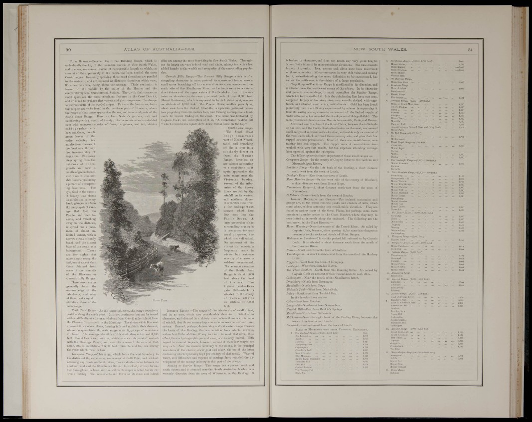
CoiST lÎASQEa.—Between the Great Dividing Rnnge, wliioh is
undoubtedly tho key of tho mountain system of New South \Valc8,
and the seo, are severo! chains of considerable length to which, on
account of their proximity to tho ocean, has hoen apjilied the toim
Coast Ranges. Goneitüly siieaking, these coost elo\-ationB ave pai-allel
to the seaboard, and are situated nt distances therefrom which vaiy,
35 miles, however, being about the average. Their contiuuity is
broken in the middle by the valley of the Himter and the
compnintlvely level tracts around Sydney. They, with their numerous
small spurs, are the most prominent features in the Coast District,
and do much to produce that variety and pictiireaqueness of landscape
BO chai-flGteristic of its wooded slopes. Perhaps the best examples in
this respect are to be found in the northern part of Dlawarra, where
the range of that uamo approaches the sea, and in several parts of the
South Coast Range. Here we have Nature's gardens, rich and
overflott-ing with a wealth of beauty ; tho mountain sides are studded
over with numerous species of ferns, bangalowa, and tall, slender
c ab b ag e-palms, mt h
here and there, the soft
green leaves of the
cedar enjoying immunity
from the ase of
the bnshraan through
the inaccessibiUiy of
its position. Clustering
vines spring from the
network of nndergrowüi
and form a
mantle of green Becked
mth hoes of innumerable
flowers, producing
a picture of unsurpassing
loveliness. The
eye, tired of the surfeit
of beauty that claims
its admiration on every
hand, glances out from
the many spots of vancage
that face the
Pacific, and then beneath,
and vanishijiir
away in the distan«
is spread out a panorama
of almost unlimited
extent, with a
narrow streak of saniiv
beach, and the distt
blue of the ocean as a
background. There
are few sights tl
more amply repay i
fatigues of ascent than
those obtained from
some of the summits
of the Dlawarra or
Currook Hilly Rang
These coast cha
generally form \
eastern edge of the
tablelands, and some
of their peaks equal in
elevation those of the
main range.
Korth Coaal Range.—As the name indicates, this range occupies a
position along the north coast. It is not continuous but can be traced
without difficulty at a distance of about from 30 to 40 miles inland, from
tho Clarence Hiver south to the Manning. The rivers which flow east
intersect it in various places, fbiining falls and rapids in their descent;
where the spurs from tho main range meet it, groups of mountains
are found. The average elevation of this chain does not exceed 8,000
feet; Mount Sea View, however, which occurs at its point of contact
with the Hastings Range, and near the source of the river of that
name, attains an altitude of 6,000 feet. Granite and trap are among
the rocks which foi-m its base.
Ulaii-arra Range.—This range, which forms the west boundary to
tho district of the some name, commences at Bulli Point, and without
attaining any considerable elevation, forma a double cim-e between it«
starting point and the Shoalhavcn Rivei-. It is chiefly of tiap formation
throughout its base, and the soil on its .slopes is noted for its extreme
fertility. The settlements and towns on its coast and inland
sides are among the most flourishing in New South Wale.s. Throughout
its length are vast beds of coal and shale, mining for which has
added largely to the wealth and jirosperity of the surrounding popula-
Curroolt Bilhj finngc.—The Ciivrook Billy Range, which is of a
sti'oggling character in many parts of its course, and has numerous
small sjnirs branching off in various directions, commences on the
south side of the Shoalhaven Rivei', and extends south to within a
short distance of the upper watere of the Bemboka River. It maiutains
an elevation in its more prominent parts of over 3,000 feet.
Mount Budawaug, which is supposed to be its highest point, reaches
an altitude of 3,800 feet. The Pigeon House, another peak lying
about west from the Poi-t of TJlladnlla, is a peculiarly-shaped monntain
projecting from its eastern face, and forming a conspicuous landmark
for vessels trading on the coast. The name was bestowed by
Captain Cook ; his description of it is, '
.•hich resembled a square dove-house w
•emarkable peaked hill
dome on the top."
South Coast Range.
—The South Coast
inge
west 0 mt Nim
tabel, and branching
off like a spar in a
aoutherly direction
from the Manaro
Range, describes an
arc almost amounting
to a semi-circle as it
again approaches the
main rang© near tho
Victorian border.
Several of the tributaries
of the Snowy
River are fed by the
rainfall on its western
and northern slopes.
It sepai-ates these from
a few unimportant
streams which here
flow east into the
Paciflc Ocean. A
large proportion of the
in occupation for pastoral
purposes, for
which it is well suited.
On account of its
elevation snow-falls
frequently occur in
winter but extreme
sevejity of climate is
seldom expeiienced.
The average elevation
of the South Coast
Range is about 3,000
feet above the level
of the sea. The
highest point—Delegate
Hill—which is
situated in the colony
of Victoria, attains
an altitude of 4,000
IxTSRinB Rakgks.—The ranges of the interior are of small extent,
and in no case, attain any considerable elevation. Detached in
character, and situated in a thirsty area, where there is a minimum
of rainfall, they do not assume importonco in connection with our river
system. Beyond, perhaps, determining a slight eastoro slope towards
the basin of the Darling, the accumulation from which, howovor,
makes but little addition, if any, to the volume of that rivei', their
effect, from a hydrographic point of view, is extremely limited. With
regard to mineral deposits, howevei-, several of these low ranges are
very rich. Near the -western boundary of the colony, in the prinoi]ml
mountains of the interior, occur gold and silver, the oro of tho latter
containing an exceptionally high per centage of that metal. Want of
water, and difKculties and expense of cai-riage, have retarded tho development
of the mining industry in this part of the colony.
Stanley m- Barrinr Range.—Tbis range has a general north and
south course, and is situated near the South Australian border, in a
westerly direction from tho town of Wilcannia, on the Darling, It
i »H i
NEW SOUTH WALES.
is broken iu cliaraoter, and does noc attain any very great height,
Mount Robe is one of its more prominent elevations. Tho baae consists
largely of granite. Ii'on, coppei-, and silver havo been discovered
in these mountains. Silver ore occurs in very rich veins, and mining
for it, notwithstanding the many ditBculCies to be encountered, has
caused the settlement in the vicinity of a large population.
Grey Range.—The Grey Range is meridional in its direction, and
is situated near the north-west comer of the colony. In its character
and general surroundings, it much resembles the Stanley Range,
which lies to the south of it. It is the cubninating line for a vast avea,
composed largely of low stony rises, very scantily clothed ^vith vegetation,
and situated amid a diy, arid climate. Gold has been found
plentifully, but the difliciilty experienced by miners in separating it
from its earthy accompanimonts, on account of the limited supply of
water obtainable, has retarded the development of this gold-field. The
more prominent elevations ore Mounts Arrowsmith, Poole, and Bi^own.
Scattered over the face of the Great Plains, between the tablelands
on the east, and the South Australian border on the west, are several
small ranges of inconsiderable elevation, noticeable only on account of
tho vast levels which surround them on every side, and give their low
rugged outlines prominence. Some of them are metalliferous, containing
iron and copper. The copper veins of several have been
worked with very fair results, but the expenses attending carriage
have operated against the enterprise.
The foUowing are the more important of these small ranges;—
Cocoparra Range—In the county of Cooper, between the Lachlan and
Murrambidgee Rivers.
Ranlin'a Range—On tho left bank of the Darling, a short distance
south-west from the to\vn of Louth.
Ditnlnp's Range—East from the town of Louth.
Minri Men-ma Range—On the west side of the county of Bla.-dand,
a short distance west from Monnt Hope.
Narrandera Range—A short distance north-east fi'om the town of
Narrandera.
D' Urhan's Group—South from the town of Bourke.
IsoLAlED Moir.vTAraa asd GliOtriS.—The isolated mountains and
groups are, as tho terms indicate, peaks and clusters of hills, which
stand alone, seldom attaining any considerable elevation. They are
fpund in various parts of the Great Plains, but perhaps come more
jn'ominently under notice in the Coast District, where they may be
seen dotted at intervals along the seaboard. The following are the
best known in the Coast District:—
Mount Warning—Near the source of the Tweed River, So called by
Captain Cook, because, after passing it, he came into dangerous
proximity to the rocks and shoals off Point Danger.
WoMnam or Tucahta—This is the peaked hill referred to by Captain
Cook. It is situated a short distance south from the mouth of
the Clarence River.
Elaine—South-east from the town of Grafton,
Yarrakapinni—A short distance west from the mouth of the Maoleay
River,
Kippara—West from the town of Kempsey.
Comhoyne—West from Camden Haven.
The Three Bruthers—North fi-om the Slanning River. So named by
Captain Cook on account of their resemblance to each other.
Coolanyulla—Near the mouth of the Shoalhaven River.
Dromedar;/—North from Bermague.
ifjim/iiiiia-North from Bega,
Wolumla Peak—West fi-om Merimbula.
Imlay—South-west from 'INvofold Bay.
In the interior there are :—
0,tiei/—Eost from Bourke.
BungavMl—North-east from Nai-randera.
Narriah Hill—East from Rankin's Springs.
Mimhison—North from Wilcaunia.
jlftP/icr«07i—Near the right bank of the Dariing lliver, between the
to^vns of Wilcannia and Louth.
iouth-east from the town of Louth.
' Modstais» with their I'uixcnvM. Ki.kvatiosb,
i-.n,(jc>0 fcot.) Kuet,
Apsley Range (aiiiDmIt)
2, .VacphcrKB flnnji.—(3,(i00—S,?!» foot.)
Mount Linclsny
Mount QIpp»
UouDtUcrlno
8. The fíiutingt Uanic.
Uounl Sen Vlow
4. N'ti«lvu:ar JlMOf.
U, Lirrrpool J7<i;ii/».—(S.SOO—1,ÍK)[)
íloiiii, or Mount McArthur,..
OSICJ'B Pcnk
Tordi
Tmi>i,Too
Jlüiiiit Temi
Miirrullii
Haiigliig Rook
Snmmll l)et« ccn BnrnaKl Rlvor,
M oil lit Pnrry
r. ThcPnllla^ai.-ii.OOOi'Xi.)
OpOUO
3,000
<,000
+,0«0
4,000
8,no
;i,4iî
.V»»»! Il,iyal An nj«.—<3,(100 feet.)
Cobre Haid
Monnt Royal
Wollen
Byrüjg
Warrumiuaglr (2,500—3,000 feet.)
Mount Exmoutli
Bnmma
>. Mu„ M.iUHUim Itat^o.—i^fiOO—i.m feet.)
Mount ülialnud
Monut Toinnli
Bunnmbang
Mount Slarsdon
Moimt lUy
:. ra» lí,"iW íanye—Cá,!>OÜ-3,OUÍ)£eet.)
Coricadgj'
S,000
l'oppoDB
Worong
Worniwoloiig
Ciullongaloiig
!. .VUfaaO'iQ //«»jr.—(2,000 fcot.)
Highest Point
1. .Va,-gu«rw <3,000—4,000 feet.)
i, OullariA {8,000 feet.)
ThcTolonong
Carmnijal
VHlâi'OHeK JfíiH¡rr.
ti Ban.jr.-(,3fi00—l,im feet,)
2,SUO
2,500
3,1 OS
'. (3,800—I.OOOfe
nerni of Kyheaii Eiver ...
Mnlndays Teak
HeaJ oí Wmlfa-<r8 Peak ... .
Niramitabel HUl
Ooolringdon
JejolieriokHill
Tatitaiigara
I. .»«oh«} (5,00<>—«,000 fe.
rf /i««/»-.-(4,ODO-i,OUO feet.)
JIumigutiil .
Sfutrj- Uoj
J[o<int Clear
Mull lit Tonuant
Taihliigi»