ATLAS OF AUSTRALIA—1886.
throiiirli it, niul connects ii with tlie milway system of the colony, tlie
di.stauce from Adelnide hy rail being about 195 miles. Popi.latiou, 729.
GOOIiWA.—CJoolwa, a town wliicL hns risen into n position of
cniisidei-able iniportftnce in conncction with the trndo of the River
Murray, is situated ou tlie i-ight bauk of the large ohaDnel bounding
Hindmarsli Island on tlio >vesc, and is distant, south from Adelaide,
about -U miles. The district of wliicli it forms tlie outlet, is botli
jiastoinl and agricultural in character, the principal products being
wool, wlieat, oats, bni-iey, and potatoes. A branch line from Jliddleton
connects it \Yith tlio western section of the Southei-n Railway. The
importance of its import and export trade is illustrated by the
following statistics:—
i m 3S.'p,ll24 ... 47,123
The commercial activity which here finds a place 5ias led to the
establisliment of several industries. There are iron foundries, shipbuilding
yai-ds, a patent slip, sawmill, flour-mill, and brewei'y. Tlie
mean annual i-ainfall is about 17 inches. Population, 688,
GORDON.—A small township on the Northern Eailway Line,
about 4o miles north-east from Poi-t Augnsta. Wheat is produced in
large quantities by the surrounding settlei"3. It is also stated that
copper occurs in the neighbourhood. Among the more recent mineral
discoveries here, are sDver and manganese. Population, 60.
GREENOCZ.—Wt.uiwd on a small tributary of the North
Para River, about 7 miles east of Freeling Railway Station, and 37
miles north-north-east from Adelaide. The settlers in the surrounding
district are engaged, for the most part, in growing wheat. Population,
2651.
GUMERACHA.—This township is situated on the left bank
of the Torrens River, »bout 10 miles north-east from Adelaide. Tbe
scenei")" in the vicinity is of an interesting character, and the locality
is a favourite place of resort during summer. Tbe surrounding
countrj- is, in some parts, gold-bearing, but only to a limited extent.
Wheat ranks among the princijial products of the district. The mean
annual rainfall is about S3 inches. Popnlation, 321.
HAHNDORP.—Ou a small ti'ibutary of the Onkapariuga
Eiver, about Id miles sonth-east from Adelaide. The district is
agricultural in character, wheat and potatoes being the principal
products. The A-ine gi'ows readily, and wine-making is carried on,
QnartK reefs occur in the vicinity, several of them bearing gold.
Population, 401.
HAI.LETT.—Situated on the Northern Railway Line, about
19 miles north from Kooringa, and 120 miles north from Adelaide.
It lies on the eastern slope of the Flinders Range, and, being at no
great distance from the culminating line, possesses an elevation of
neariy 2,000 feet above the level of the sea. A very large area
within the district is under cultivation every year, wheat being the
chief product. Population, IS7.
HAMILTON.—This township is situated on the upper waters
of the River Light, a short distance below tbe confluence \rith it of
Totbill's Creek, about 10 miles north-north-west from Kapunda
Eailway Station, and 51 miles north-north-east from Adelaide. The
surrounding country is largely agricultural in character, and to some
extent pastoral. Wbeat, and cereals generally, are the principal
products. Population, 142,
H A M L E T BRIDGE.-Near the right bauk of the River
IJght, a short distance above the confluence with it of the Gilbert,
and lying about 44 miles north, by railway line, from Adelaide. The
district is an agi'icultural one. Population, 213.
H A N S O N . - S i t u a t e d on the North Railway Lino, at an
elevation of over 1,400 feet above the level of the sea, and distant
north, from the metropolis, about 87 miles. The district is both
pastoral and agricultural. Wheat and hay are among the principal
products of the soil. Population, 148.
HARROWGATZ.—(.)n the Eiver Bremer, a short distance
from its source, about 25 miles east from Adelaide, and 8 miles northeast
from Nairne Railway Station. ITie country around is of a hilly
character, and settled upon for agricultural and grazing purposes.
Population, 117.
HAWKER.—1)11 the Great Northern Railway Line, about Oo
miles north-east fi-oiu Port Augusta. The district is, to a large extent,
pastoral in character. The situation is elevated, being over 1,000
feet above the level of the sea. Copper is among the mineral
products of the locality. Population, 142.
HOG BAY.—Hog Bay is a small settlement on Kangaroo
Island, a short distance to the east of Nepean Bay, about 12 miles
south-west from Cape Jervis. The strait known as Backstairs
Passage lies between it and the mainland. 'I'his portion of the island is
suited to agriculture, the chief pi'oducts being cereals. There is regular
communication by steamer with the metropolis. Population, 17G.
HOUGHTON".—Situated a short distance north from the right
bank of the Eiver Torrens, about 12 miles north-east from Adelaide,
The district is both ngriciiltural and pastoral. Populntiou, 115.
I N G L E W O O D . - A small township in the valley of the River
Tori'ens, about 13 miles north-east from Adelaide. Gardening and
fruit-growing are carried on in the neighbourhood, the produce, which
is of ft varied eharactor, finding a ready market in the metropolis.
Population, InS.
JAMESTOWN.—Jamestown is situated a short distance west
from the right bauk of the Bolalie Creek, about 52 miles east from
Port Pirie, and lies at an elevation of nearly 1,500 feet above the
level of the sea. The sun-ounding settlers are engaged, for the most
part, in agriculture, the chief products being wheat and hay. The
almond tree grows readily in the locality. The railway line from
Petoi-sburgh to Port Pirie passes through it, and connccts it with
the metropolis. Among its institutions of a public character is a
hospital This to^vnship presents an attractive appeanince, and is a
commercial centi'o of some importance. Population, f)Si3,
KADINA.—Kadina, a mining to^vn of some importance, is
situated at the northern end of Yorke's Peninsula, about 6 miles
inland fi'om Wallaroo Bay, and about 100 miles nortli-west from
Adelaide. Extensive deposits of copper are found in the neighbourhood,
and in connection witb mining for this metal, has resulted much
of the progress of the township. It is connected by railway line
with Adelaide, ^^'allaroo and Jlooiita Bays in Spencer Gulf, and
Port Wakefield, near the head of St. A'inceut Gulf. A line also
branches off from this point in a north-east direction to Snowtown.
Much of tbe sui'roundiug country is settled upon for agi-icultural
irposes, wheat and hay being the principal products. The mean
iialr: nfall is ibout 15 inches. Population, 1,521.
KANMANTOO.-lCaumantoo is situated near the right bauk
of the Bremer Eiver, about (Si miles east-south-east from Nairne
Railway Station, and 27 miles sontli-east from Adelaide. The settlei's
in the district are, for the most part, engaged in agricultui-e. Grapes
are extensively grown. Copper deposits of considerable value occur
in the vicinity. Population, 170.
KAPUNDA.—Kapimda hns its origin in tbe great mineral
discoveries of 1842, and o\vcs much of its prosperity, during past
years, to the richness of the copper mines in the vicinity. With the
increase of population, the surrounding country has become settled
upon, and divided into farms. The soil is fertile, and extensively
cultivated, t i e staple products being wheat, barley, and hay. Vineyards
are numerous, and wine-making is carried on. Rearing cattle
and sheep-farming contribute also to the prosperity of the locality.
The town contains many good substantial buildings; among tiose of
a public character ai-e the hospital, coui-t-touse, post and telegraph
offices, and churches. A reserve for recreation pui-posea adds
considerably to the attractiveness of the situation, Kapunda is
situated a short distance north from tbe right bank of the Eiver
Light, about 48 miles north-east from Adelaide, and lies at an elevation
of 7-ib feet above the level of the sea. The North Railway Line
passes through it, and provides ready communication with the
metropolis. The mean annual rainfall is about 20 inches. Population,
2,200.
K E I L L I . — y e a r Ingram's Gap, about 12 miles inland from Port
Broughton, and about 100 miles north-north-west, iu a direct line,
fi'Om Adelaide. The district is largely agricultural in character.
Population, 74.
KINGSTON.—Kingston, situated near the mouth of ilaiia
Creek, on the margin of Lacepede Bay (the harbour being known as
Port Caroline), and forming the outlet of a large extent of country, is
of considerable importance commercially. The distance from Adelaide
is about 150 miles, and from Jlelboume 280 miles. The port, though
of an open character, is safe, and affords wharf accommodation for
shipping of the largest tonnage. It now forms the tenninus on the
coast of the Southern lUihvay Line, by means of which it is in direct
communication with the metropolis, l/arge quantities of wool from
the country exteuding east to, and north along, the Victorian border,
arc received here for direct shipment to manufacturing centres. The
importai — • ' • • • - m the
following statistics, as to the value of its import« mid nvpnrfs .,ver a
period of five years:—
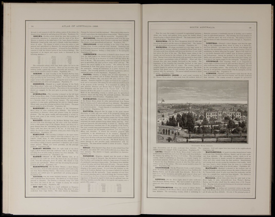
SOUTH AUSTRALIA.
Near the coast, the country is occupied for agricultural purposes,
wheat, oats, bariey, and potatoes being growu, but farther inland,
sheep-farming is almost entirely followed. The mean annual rainfaU
is about 22 inches. Population, 256.
KOOLUNGA.—Oil the River Bronghton, about 23 miles east
from Port Broughton and the waters of Spencer Gulf. 'J'he district
is both agricultural ond pastoral iu character. Pojjulation, 98.
KOORINGA.—Kooringa, associated to a very largo extent iu
tbe post with the mining industry, is situated on Burra Creek, about
100 miles north from Adelaide, and lies at on elevation of over 1,500
feet above the level of the sea. The Burra copper mines, in the
vicinity, are well kuowu for the richness of the ore obtained therefrom.
During former years, the annual yield amounted to about 2.500
tons of copper, representing a value of £200,000. Silver and other
minerals have also been recently discovered in the locality. Tiie
importance of the township has somewhat declined of late years
ovring to the reduced value of copper. The country around is
occupied lai-gely for pastoral ond agricultural pui-poses. The North
Railway Line passes near it, and furnishes the means of communication
with the metropolis. The annual rainfall amounts to about
17 inches. Population, 2,647,
L A N G H O R N E ' S CREEK.—A small postal township on
the Bremor Eiver, about 7 miles north from the northern shore of
character, possesses a considerable amount of fertility, and is settled
upon for agricultural purposes. The township lies ill on elevation of
over 1,000 feet above the level of the sea. Thu railway to Goolwa
and the shores of Lake Alexandrina jiasses through it. Population,
2GI.
LOBETHAL.—Siiuiited a short distance west from tbe right
bant of the Onkaparinga River, about IS miles, in a dii'pct line,
east from Adelaide. Low spnrs from the Mount Lofty Ranges add
variety to the surrounding country, iu some places forming a series of
undulations, in others, rising into low peaks. Jlach of the land is of
a very fertile character, and is settled H))on bj- farmoi-s, gardenei-s,
and iriiit-growers- Among the products of the locality are wheat,
bariey, oats, and potatoes. Grapes and other ft-uits grow readily, and
form part of tbe regular supply for the metropolis. Population, 220.
L U C I N D A L E . - T h i s township, which is of comparatively j
rocent origin, is situated about 31 miles east from Kingston, and 175 •
miles south-east from Adelaide, Wheat-growing is largely followed
by the surrounding settlera. The railway line to Kingston passes
through it, and provides communication with the metropolis, and the
coast fit Lacepede Bay, Population, 73,
LYNDOCH.—Situated a short distance south from the North
Pai'a Eiver, about 6 miles east from Gawler, and 28 miles north-east
from Adelaide. The country around is occupied for agricultural
Laki idrina, am
lettlers around are engt
L A U R A . - S i l u a t c
lorth-west from Gladst.
I i
¡outh-east from Adelaide. The
liiefly in agriculture. Population, 57.
the Rocky River, about 7 miles northnd
about 120 miles north from Adelaide,
the distance by railway line being much farther. The surrounding
country, which is undulating iu character, is occupied largely for
igricultural purposes, wheat and hay being the principal products.
A branch line from Gladstom
railway system of the colony,
inches. Population, 828.
LEASINGHAM.—On t
of the Wakefield River, about
Kailwoy Station, aiul l!5 miles north from Adelaide. Slueh of the
laud is of a fertile description, and yields good crops of wheat and
other cereals. The vine flourishes in the neighbourhood. Population,
78,
L l N W O O D . - ( ) , i the River
from Stockport Itaihvay Station,
wheat and other cereals being the
78.
L I T T L E H A M P T O N . — N e a r
Creek, a tributary of the Bremer P
from Adelaide. The surrounding c
witb Poi-t Pii'ie and thi
about 16
lie Creek, a small tributary
rtli-west from Saddleworth
Light, about 3 miles south-east
riie land is suited to agriculture,
principal products. Population,
: Barker
er, about 20 n suth-east
mtry, which is
purposes. Gold and copper have been found i
Population, 448.
M A C C L E S F I E L D . - A postal township,.situated about 7 miles
north-west fi'om Strathalbyu Railway Station, and 23 miles southeast
from Adelaide. The surrounding country, which is of an
undulating character, is largely occupied for agiicultural puiposes,
wheat and other cereals being the chief products. Sheep-farming
and rearing stock are also among the industries of the locality. Gold
has been found a short distance from the to^vn, in a north-west
direction, the workings being of an alliinal nature. Population, 227,
MAITLAND.—Maitland is situated in the northern part of
Yorke's Peninsula, nearly midway between the waters of Spencer and
St, Vincent Gulfs, about 15 miles west from Port Ardrossan, and 04
miles, in a straight line, north-west from Adelaide. The district is
both agricultural and pastoral. Poj)ulat!on, 177.
M A L L A L A . - . \ b o u t three miles from the right bank of the
River Light, 11 miles west-north-Avest from Wnsley's Railway
Station, and 14 miles inland from the eastern shore of St. ^'inceut
Gulf, Rearing stock and general farming are the principal industries
of the locality. Population, 2111.
M A N N U M . — t r a d i n g aud commercial centre, on the right
bank of the Murray River, about 23 miles south-east from Gumeraeba,
and 42 miles east from Adelaide. It is one of the principal points of