Lftko Nyassa.
ab* te mUsr-Vqiûb ftynl'lb ta loo P&L lb it visitai
art*kìghcr1hiin to the S. J nan to rito out of the
farther S. is savi to bo high Table Zantl.-TothoJf.of
Otiavnasul. the Sanvet toil round the S. m i, but
never unit it-'FkePopulaàen onils Shores is very dente
Xotangbyi
Terr High Plait
‘DtuPelai ^jMalemo 1.
lyfotuepcs B.
L A K E N Y A S S A uootìè
Ji'¿rimili
1 M i p!
dmadUaeeee| L'Urlo B.
Aliueida B.
Ik' Sophia
Kebrg-Tjoso. Rocks & Rapids.
Morumlma.E. of Oiiema Flain.it the nuat fonmdeble .
the Calanuti ti must always farm a burner to nayigentm,
ordinary law wotert’méu namw Borge or6atcwyt.m*
ifo GuaraeU-exat. die perpendicular rue of water u Bor
it aJanteiìtrariautplaau wàh the white foam of a, to
•bar of small Sapide ■
^}Vnu«bV(U
Table Ml 0
^ondlffr^s
TioXii
iQuiliiniuic.
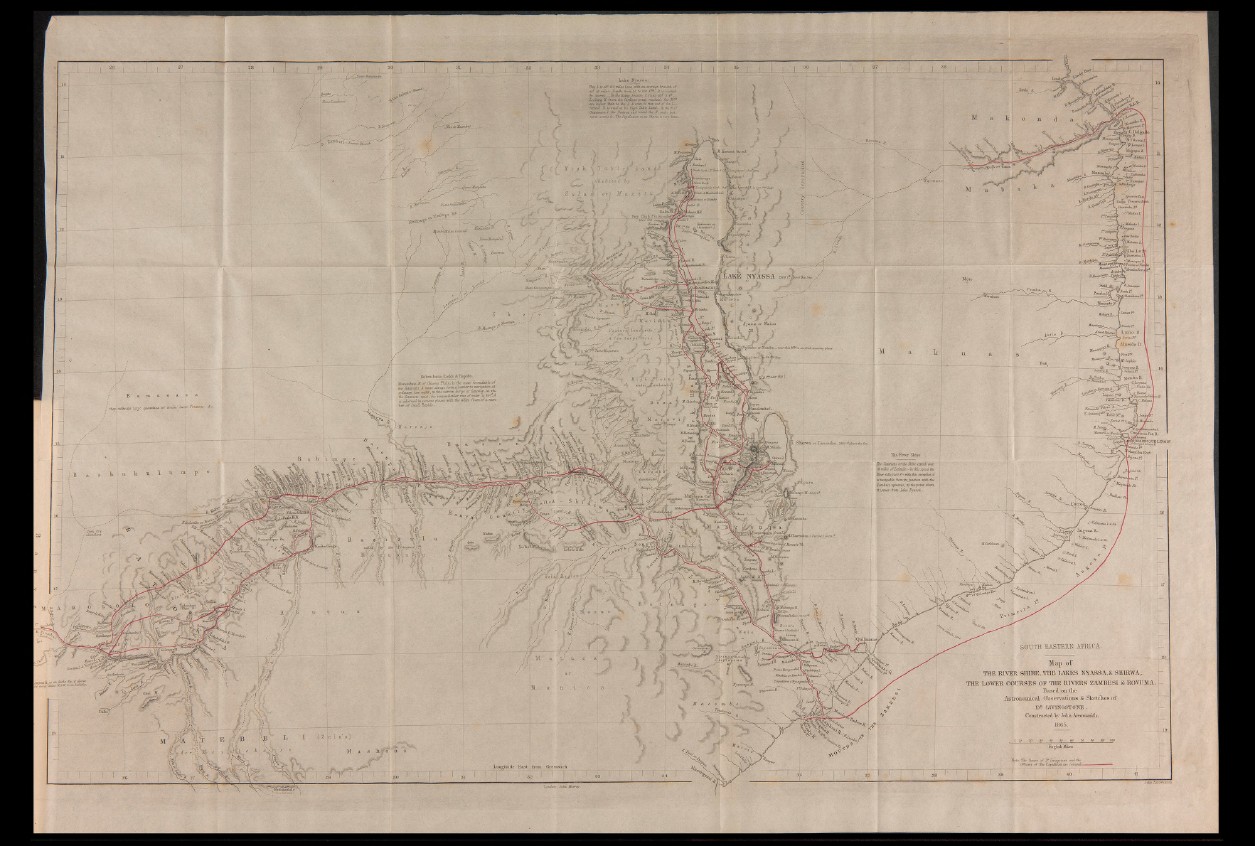
SOUTH EASTERN AFRICA.
Map of
T H E RIV ER SH IR E ,.TH E LAKES NYASSA.& SHIRWA,.
T H E LOWER C 0U R S E S OF THE R IV ER S ZAMBESI & ROVUMA,
Ba sed on the
A s tro n om ic a l - Oh s e rv a tio n s ¿ Sk e tch es o f
D“ LIVINGSTONE.
Constructed h e Jolin Arrowsnnth,
1865. . ,
■I’liitrn'on .
English Mile
Longitude Enst I from. Greenwich
'Ionion, John Hurray.