ATLAS OF AUSTRALIA—1886-
BOOLBOONDA.-Xeor the source of the Gin Gin Creek, a
tributary of tlie Kolan River, and situated on the railway line from
Bundabei-? to Mount Perry, being distant fi-om the former 56 miles.
'I'ho country in the immediafce ricinity is auriferous; towards Mount
Perry occur deposits of copper. In tlie valleys of the Burnett and
Kolan Risers, the laud is fertile, and suited to cultivation and grazing.
Immediately to the west and south, are the Burnett Range and its
numerous spurs rising above the general level. Population, 188.
BOOLBIIB.K.A.-Un the right bank of tbo Dawson River, a
short distance above its confluence with the Fitiiroy. It is situated on
the Central Rail^-ay Line, which has its terminus on the coast at
Rockhanjpton, being about 58 wiles inland therefrom. Settlement
has taken place, to some extent, in connection with the cultivation of
the soil. The district is, for the most part, a pastoral one. Population,
22, ^
B O i r L I A . - A n important commercial centre, and postal tovvnship.
in the Gregory District. It is situated on the right bank of the
Burke River, about ItjO miles south from CloncniTy, and lies 180 miles
east from the west boundary of the colony. The countiy around
consists, for the most part, of high open downs, with light brown
loamy soil. These, except where ranges of a stony character are
found crossing them, are well grassed, and suited to the pasturing of
sheep and cattle. The numerous streams, which have their rise in
the Selwyn Range and the culminating line of the Tableland on the
north, intersect the k.id in various parts, furnishing a good natural
supply of water, well distributed for stock. The timber, generally,
is of a light description. Large runs are the rule in this portion
of the colony, Progress has been somewhat retarded hitherto, by
the difficulty encountered in foi-warding prodnce to the seaboard
for export. This obstacle, however, is one that will gradually disappear
with the extension of tbe railway bnes into the interior
Population, loi .
BOWEN.—Bowen is an important seaport town on tht
shores
of Port Denison, an inlet of Edgecumbe Bay, The harbour „
modious and safe, and is a frequent port of call for coasting vessels
and steamships proceeding north to Torres Strait by the inner
passage. Regular communication is maintained between it and
Brisbane, and other ports in the Australian colonies. The value of
the import« and exports during the five years ended 31st December
1884. were:—
very large area of pastoral
^t ranges, and including part
upper bai'
Bowen is the natural outlet foi
country, extending west beyond the
of the valley of the Burdekin, and _
rivers flowing into the Gulf of Carpentaria." In the neighbouÀóod of
the coast, and for some distance inland on the banks of the Don
Burdekin, and Bogie Rive.-s, the land, climate, and general surroundings
suit the growth of the sugar-cane. Maize and sweet potatoes are
also grow-n to some extent. There are numerous orchards containing the
varions fruits of tropical and semi-tropical counti^ies. Many of° the
settlers have given their attention to rearing stock, and a considerable
amount of success has attended the enterprise. The Marengo and
Normanby Gold-fields lie to the south of Bowen—the former in the
vaUey of the Don River, and distant about SO miles, and the latter in
the basin of the Bowen River, at a distance of 50 miles. To the west
of Clarke's Range, between it and the Leichhavdt Range, hare been
found extensive beds of coal, the seams varying in thickness between
6 and 8 feet. The only obstacle to development of coal-mining in
tbis part of the colony, ia the absence of ready conveyance to the
coast ; as settlement increases, however, the construction of railways
will tend to diminish this difficulty, and ultimately cause it to disappear,
A pier extends into the waters of the harbour for a distance of about
2,700 feet, and furnishes ample accommodation for shipping. Manufacturing
enterprise is represented; in the locality are sawmills,
sugar-mills, and meat-preserving works. The latter are situated on
Hope or Poole Island. Bowen possesses good substantial buildings,
Dalby. The laud on the banks of the Condamine and its numerous
tributary streams, is well suited to agriculture. Reai-ing stock also
engages attention. Coal is known to esist in tbe upper part of the
Oaky Creek VoUey. The railway line from Brisbane, west towards
the interior, passes a short distance to the north. Bowenville lies at
an elevation of over 1,200 feet above the level of the sea. Population,
47.
B R I S B A N E . - B r i s b a n e , the metropolis of Queenslaud, took its
rise while that colony still formed a part of New South Wales, For
some years previous to 1823, the prisoners at Sydney had become so
numerous, that thorough and effective discipline was a matter of
considerable difficulty, and the greatest caro was necessary to prevent
insubordination. Under these cii-cumstances, it was decided to form
new settlements, aud so weaken the criminal element by division.
Moreton Bay was selected, aud proclaimed a convict settlement in
August, 1826. Between this year and 1880, stations were estab-
Ushed at Eaglo Farm, Ipsmch, and Hedbank, and considerable
areas of land were cleared, and placed under cultivation by the
pnsonei-s. Exploration had also extended south and south-west along
the banks of the Logan Rivev. About the year 1842, Biisbane was
laid out as a town, and a sale of town lands took place at Sydney, the
average price realised being £356 per acre. During 1845, sales of
town lands were held at Brisbane, As the interests of the new
settlement began to diverge from those of the govemii
progi-ess was retai'ded by insufficient attention to the f
centre, and
of a young community, a considerable
wijig wants
was engendered. This resulted, ultimatel
imount of dissatisfaction
in sepai-ation from New
and the various institutions of a public charactei
towns of equal importance. Population, 982.
B O W E N DOWNS.-A postal township, o:
•ally found in
n the loft bank of
r, about 110 miles
Cornish Creek, a tributary of the Tliomsoi
north-west from Jei'icho Railway Station,
mtrj' around
consists, to a large c.Ttent, of open downs, well grj^sed
covered, in some places, with brigalow and boree. The district is
almost entirely a pastoral one. Population, 20.
B O W E N V I I . L E . - u . , the right bank of Oaky Creek, a
tributary of the Condamine River, about 16 miles south-east from
South Wales, and the proclamation in 1859, of a new colony,
the name of Queensland, was made amid much rejoicing. With all
the benefits attaching to local government, the progi'ess of Brisbane,
since that date, has been rapid and uninteiTupted. It now holds a
prominent place among the cities of AustraUa, its ti-ade extending to
the sister colonies. Great Britain, and the chief commercial centres of
the worid. The following statistics xs-ill illustrate the value of its
imports and exports during the five years, ended 31st December,
£l.l«c;,6f,8 fMs a " «
I.58C,0BJ 2,104,802
• - 1,431,032 2,<J9I,34.1
2,081,302 3,11J,507
1,S!IB,62I S,<;C>7,W8
Moreton Bay, which was discovered by Captain Cook in 1770, is a
large ex-panse of water, protected on the east fi^om the gales of the
Pacific Ocean by Stradbroke and Moreton Islands. Between the
north end of the latter and Bribie Island, there is a passage of
considerable width. The strait separating Moreton aud Stradbroke
Islands, and k-nown as the South Passage, is narrow, and only entered
by coasting steamers of Ught draught, during daylight. A bar at the
entrance increases the difiiculty and danger of navigation.
Brisbane is built on the banks of the Brisbane River, about 22
miles, following the course of the stream, but only about 12 miles in a
straight line, inland from its mouth. It is situated in latitude 27° 28'
ind longitude 153° 6 ' east, aud lies about 500 miles north from
Sydney,
feet.
The
above the level of the s¡ « to about 58
•r. almost throughout its course, is of a remarkably winding
nd is obstructed at its embouchure by a bar. Originallj-,
jnly 4 feet at low water on this shoal, but, by means of
lear depth of 15 feet for a ividth of 200 feet has been
Tbe channel up to the town, has also boon deepened, aud
character, t
there wore
dredges, a i
obtained.
otherwise improved, so as to admit shipping within easy reach of the
commercial centre. There are good wharfs, but i
trade has pointed to the necessity for increased acco
respect, The position of the channel, at the entrauce, is indicated by
lights at night, aud shoals and other dangers are marked by beacons
and buoys. The two sections of the town, k-nown respectively as
North and South Brisbane, are connected by a very fine iron bridge
across tbe river. This structure, which bears the name of Victoria
Bridge, has a total length of about a quarter of a mile.
r extending
The direction of the principal streets has been detei-mined, to a
large extent, by the coui^se of the river, some boing parallel thereto,
and othera approximately at right angles. The country around is
undulating in character, with low ranges in the background. Tho
municipal boundaries include an area of 2,183 acres, and the value of
rateable property for 1884, amounted to £839,172. The importance
of Brisbane ia not only due to the fact that it is tho outlet and commercial
centre for a laud of vast extent, fertile, suited to a widely
— • ' • agriculture, and containing stores of mineral treasures almost
nexhaustible, but is, in
.ne of tlie principal routes botw<
natural result of its posi
I the colonies and tho itions of
QUEENSLAND.
the Old World. Immediately west from Brisbane, there is un extensive
coal formation, and recently, seams with a thickness of about
41 feet have been readied, at depths of from 100 to 150 feet. Tho
coal has been proved to be of a very good quulity, and likely to be in
demand for fuel,
Manufacturing enterprise is largely represented. This has increased
commercial activity, and in promoting the inimigi-ation of
skilled workmen iu various trades, has added considerably to the
po])ulation. There aie cordial manufactories, brick works, soap and
candle works, distilleries, foundries, fruit-preserving works, ropawalks,
sawmills, tanneries, machinery aud caiTiage works, and a diy dock
capable of receiving vessels of large tonnage,
The town possesses botanical gardens which are not only artistically
laid out, but well kept. There are also the gsirdens of the
Acclimatisation Society, and sovewl parks. Mnuv of the bankswarehouses,
shops, places of business, ciuirches, government offices,
and other buildings, arc both ornamental and substantial, possoiising
a considerable amount of architectural beauty. Among the "tructui
of a public character may be mentioned, the Houses of Legislature,
Post and Telegraph Office, Law Courts, Government Printing
Oflice, Government House, Custom House, Museum. Railwav
Station, Registrar-General's Office, Hospital, Ports and Harboui-» " i
Oflices, and the Lands Office.
Brisbane reçoives itswatersupjilyfi'om
lake formedby therainl
slope of D'Acquilar's Range,
is carried through mains a
distance of 7 miles to the
city. The reservoir lies at
an elevation of about 240
feetabove the level
of tho sea.
The climate is
dry, and regarded
as healthy. Dur-
Large quantities of grapes are growji, and wino-mnkiii mpted.
Tho river, which is easily entered, is navigable fur tho
going steamers engaged iu the coasting trade, from the soa to the
town. There are two entrances, that nearest Uervey Bay being tbe
only one used. The other is full of shoals and sand-banks, and is
diy in some parts at low wator. There is a bar at tlio main entrance,
but except at low water, when tho dopth is only 6 feet over it, and
during s tomy weatber. it presents little diiiiculty to coasting vessels.
Buudaborg is the natural outlet for a large extent of agricultural
and pastoral country, including the vaUeys of the Uurnett aud Kolan
Rivei-s. A glance at tho increase in tho value of its imports u.id
exports during tbe four yeai-a euded December, 1884, furnishes
evidence of its rapid progress:—
... 0n,3U0
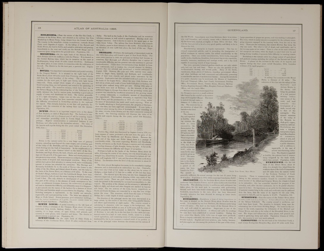
lonnects it with Mount
of 66 miles. The
J into the valleys of the
Rawbelle and
Auburn Rivers, in
the future, will
bring tho products
of a rich pastoral
territory within
easy a
coast, and tend
t o w a r d s the
annual temperature
in the shade,
from 18(59 to 1884,
a period of 16
years, has been
found to be 70'2''.
Tho rainfall is
geuei-ally sufficient, the
49'60 inches. Population in ;
BKOUGHTON.—On
south-east h'om Charters Tov
TownsvilW. Tho adjoining coiiutry is aurifei
taken place, for the most part, in connei
Several roofs have been found containing gc
Gold-field, iuunediatoly to the east, silver
liocputly, attention has been directed to i
Population, 28.
25 years being
upal boundaries, 32,567.
about 14 miles eastitli
south-west from
and settlement has
with gold-mining.
In the Raveuswood
been discovered,
g at lower levels.
BTTNDABERG.—Hiiuilaberg, a town of rising impoi-tance on
tlie coast, is situated on the Uurnett River, about 10 miles from it-s
mouth. It is reached by sea from Brisbane, the distance north being
about 272 miles. The land on the banks of the Burnett River is
rich, and well suited to agriculture. Sugar-cane is one of the
lii-incijial ijroducts of the district. A refinery and mills for crushing
tlu- cane have been established in several localities. During tbe
year ended 3Ist March, 1885, 5;!>54 tons of sugar were produced.
Jlaize is largely cultivated, the returns showing a yield for 1884, of
1UH.422 bushels. English and sweet potatoes, oats, barley, banuna.s,
and pine-apples are also among the products of this part of the colony.
school of arts, and
otherinstitutionsof
a public character,
aud in addition to
ills, is the seat of
ifacturing industries.
The climate is regarded
' as healthy, the extreme beat of summer
boing tempered by the trade winds,
which then prevail. Population, 2,323.
B r B , K E T O W N . - O n the left
bank of the Albert River, about 21
miles, in a straight line, inland from the
southern shoreof the Gulf of Carpentaria,
and 100 miles fi'om the eastern border
of tho Northern Territory of South
nunication with Brisbane by steamer,
larshes, formed in connection with the
of the Albert- and Gregory Rivers, tiie climate is fonnd
to be unhealthy; this has somewhat retarded the progi'ess of the
township, and, after the first settlement, led to its partial abandonment
for a time. Its importance, as an outlet for tho immense extent
of pastoral country lying to the south and south-east, may be gathered
from the facts, that the value of its imports for the year 1884,
amounted to .£20,795, and its exports, to £1,475- Population, 102.
BYERSTOWN.—Near the source of the Palmer River, about
05 miles south-west from Cooktown. It has suffered from the decline
of the Palmer Gold-field. 'J'he country around is auriferous, and
reefs have been found. The situation is elevated, being near the
culminating line of the Great Dividing Range. Tin occurs in the low
range to the south, separating the tributaries of the Mitchell and
Palmer Riveií!, aud, also, in the valley of tho Bloomfield River, to the
east- Tho slopes and valleys are, in many places, well grassed, and
suited to pasturing sheep and cattle. Population (Census of 1881),
121); this number is uow very much reduced.
C A B O O L T U E , E . -( n, the left bank of the Caboolture Creek, a
small stream flowing into Deception ]5ay, about 30 miles north from