ATLAS OF AUSTRALIA—1}
The Saicbifha Creek, Annie, and Saltwater R-ivers are small streams
Howing iuto Prinecss Clinrlotte Bay.
Nurth Kennedy.—Tins river lias a northerly course, and falls into
Princess Charlotte Bay. Its principal tribut-aiies are the Baiin or
Basalt Biver and Station Creek.
Normanby.—The basin of the Nonnanby River is bounded on the
east by a sandstone tableland, which separates it from the valleys of
the Jeannie nud Starcke Rivers. It follows a course to the north,
and reaches the sea at Priucess Charlotte Bay. Some distance inland
from the mouth are found extensive mangrove scrubs.
The Jeanyiie River has a noi-th-east coui-se, and falls into the ocean
west from Red Point. The Starcke, \vith a course almost parallel to
the last-named, reaches tbe sea west from Murdoch Point. The
Morgim River rises in a sandstone tableland near the coast, and flows
south, and ultimately east. The JEndeavour reaches the coast north of
Monkhouse Point. A short distance to the south is the il?mn?i liioer.
The coui-ses of the Endeavour River and Oaky Creek ai-e limited by
one of the tributaries of the Normanby. The Bloiymjield Rivulet has
its embouchure at Weary Bay. A short distance to the south, there
is the Daintree Siver. The Moaimim and Mowbray Rivers are of an
nnimportant character. They rise in a part of the Dividing Chain,
distant only about 7 miles from the seaboard.
Barron.—^Tho Barron River has its source between the main
chain and an eastei-ly spur called Lamb Range, and at first flows
north. It subsequently turns to the east, reaching the sea at Trinity
The Malgravc River rises between the Bellenden Ker and Lamb
Ranges, and has a very circuitous course. Its principal tributary, the
Ruisdl River, receives part of its waters from the slopes of Mount
Bartle Frere.
/o/iiisioue.—^Tlie Johnstone River has it-s origin on the northeastern
slope of a spur from the main chain.
The Moresby River, Liverpool and Maria Creeks, are small unimportant
streams. The TuUy and Murray Ritert, and Dtillachy Creek,
flow into Rockingham Bay.
Herbert.—The Herbert River rises in the Dividing Chain, and
receives part of its waters from two spm-s branching towards the
coast. It flows, at first, to the south, then south-east, parallel to
Sea View Range, and as it approaches the coast, it divides into several
mouths, emptying its waters into Rockingham Channel, opposite the
south end of Hincbinbrook Island. lu one part of its course occurs
an immense fall, the noise of which, it is said, can be distiuguislied at
a distance of 12 miles.
The Black and BoliU Rivers ai-e small streams; they rise near
Mount Jfargarct. The iiuss ifirer flows into Cleveland Bay. The
Eoughton has its sonrce near Mount Square Post, and reaches the
coast at Bowling-green Bay.
Burdekin.—The Burdekin, one of the principal rivers of the
east coast, has its souree on the soutb-western slope of the Sea View
Rauge. Its upper course lies between these mountains and the main
chain, It has a general direction to the south-east, and for a distance
of over 200 miles runs parallel with the coast line. Floiring through
a gap in the Coast Range, a sudden turn is made to the north, and
the sea is reached by two mouths between Cape Bowliug-green and
Upstart Bay. It« pi-incipal tributary, the Bdyando, has a northerly
course; it rises between the Drummond Range and the main chain,
immediately south of the 24th parallel. Some idea of the large
estent of country drained may be gathered from the fact that the
source of the Belyando is over 500 miles south from that of the
Burdekiu River. The principal tributaries are Ciorke'x, Star, and
Basalt River», and Gray, Keelboltom, and Lolworlh Creeks. The
waters of the Belyando River are aiigmented by several important
streams, among which are Mistake, Carmicliael, Dimda, Lagoon, Alpha,
and Bully Creehe. The Sutlor Rive^-, in the lower part of its coui-se,
receives the Cape River from the west before it joins the Burdekin.
The sources of the Cape and its affluent, the Camjiaspe, are situated
amid extensive spurs from the Dividing Chain, possessing an elevation
of 2,.^00 feet above the level of the sea. These are of granite foi-mation.
On the uortb bank of the Lolworth Creek an immense wall of
basalt separates it from Flelclier's Creek. The B'wen River flows
north-west between Leichhardt and Clai-ke's Ranges, and joins tlie
Burdekiu immediately after it turns to the north. 'J"he Bogie River
lies on the north-eastern flank of Clarke's Range, and joins the main
stream some distance below the confluence of the Bo wen. The
country around the sonrce of the Burdekin is of a very broken
character, and contains large deposits of tin. Imrocdiatflly above its
oonfluence with the Suttor River is the Charter.^ Towers gold-field.
Silver also occurs in several places in the basin of the Bui-dekin.
Near its embouchure the land is taken up for sugHi--gi'owing and
general agricnltnre.
The Wangaratta, Rocky-pond, and Molonglo Creeks are small
streams which flow into Upstart Bay. The Elliot Rivifr reaches the
coast at Abbott Bay, the Eiirie Creek and Don River, west of Cape
Edgecumbe, and tbe Duck Creek and Gregory River, near Port Denisou.
The Proserjnne and Thompeon's Creeks, and the O'Connell River, empty
their waters into the head of Repulse Bay. The Pioneer iiiver issues
from the Coast Range, and enters tbe sea south of Slade Point. From
this part of the coast, south to Keppel Bay, ai-o numerous small streams.
The following may be mentioned:—Sandy Creek, Bell's Creek, Cherrytree
Creek, Rockydavi. Creek, Marion Creek, Ba>n,i Creek, Weslhill
Creek, Scrubby Creek, Clairview Creek, St. Laivrence Creek, Waverley
CreeJc, River Stym, Herbert Creek, Wadallah Greek, Shoalwater Creek,
and Cawmral Creek.
Fitzroy.—The upper waters of this important river are collected
by three main streams—the Dawson from the south, the Mackenzie
from the west, and the Isaats from the north. The country drained
possesses a length fi-om north to south of over 350 miles, and a width
fi'om east to west of about 250 miles. The Dawson issues fi-om the
Great Dividing Bange immediately south of the Carnarvon Range.
Its general direction, at first, is to the east. As it skirts the eastern
extremity of Bigge's Range, it turns to the north. Numerous tributaries
join it from the main chain, and its spurs. The volume of the
Mackenzie is maintained by the watera of Theresa and Retreat Creeks,
and the Nogoa and Comet Bitere. In addition to those named, this
receives
Peak, Dr
- number of tributaiy streams from the slopes of the
, and Expedition Ranges, aud also the
Dividing Chain and Buckland's Tableland. The Isaacs Ri
in a south-east direction from the Denham Range. Its basin is formed
on the east by Connors and Broad Sound Ranges. As they approach
the Tropic of Capricorn the joint waters of the Mackenzie aud Isaacs
Rivei-s give rise to a series of small ana-branohes. After receiving
its three principal affluents, the Fitzroy skirts the southern extremity
of the Boomer Range, and turns to the uorth. Finally, with a southeast
course, it reaches the sea, at Keppel Bay. Its length is considerably
increased by its numerous windings. Its extensive basin is,
for the most part, well grassed, and forms runs for uumei-ous herds
aud flocks. Near its embouchure, the land is taken up by settlers
for agricultural purposes. In the valley of Cooper Creek, a tributary
of the Isaacs River, there are rich deposits of gold and copper; the
same metals are also found near the source of Sunday Creek, an
affluent of the Mackenzie Rivoi'. The fii-st discovery of gold and
copper in Queensland was made on the banks of the fitzroy, near
Rockbampton.
The Calliope River has its source in the Coast Range, and flows
north-east into the narrow channel sepai-ating Curtis Island from the
mainland. A few miles farther south is the Boyne River. This
stream rises on the eastern slope of Dawes Range, a part of the
Coast Range, and after following a course to the north, reaches
the sea at Port Curtis, where it forms two mouths. The watei^ of
Baffle Creek issue, for the most part, from a spur of the Coast Range.
Its course is, at first, to the south-east. South of Mount Maria,
it turus to the north-east, and as it approaches the sea, the direction
becomes an eastei-ly one. The Kolan River flows east from the
Burnett Range, and receives part of its volume from a spnr from the
Coast Range lying between its basin and that of the Boyne River.
Burnett.—Tbe Burnett, one of the principal rivers of the slope
towards the Pacific Ocean, has its origin in the Great Dividing Chain,
its basin being bounded on the west by a spur, on the north by Dawes
and the Burnett Ranges, on the south by the main chain, including
Craig's Range, and the Bunya Bimya Mountains, and on the east,
by the Cooyar and Coast Ranges. The countiy drained represents an
area of not less than 13,000 square miles. Tbe following are tbe
chief tributary streams •.—Bavambah Creek, Boonara Creek, Stuart
River, Boipie River, Auburn River, Rawhelle River, Three- Moon Creek,
Splinter Creek, Bo^jour Creek, Sunday Creek, Degilho Creeli, and Perry
River. The general direction of the Hiimett, in its lower coui-se, is to
the north-east. Gold, copper, aud antimony are found in various por-
' tions of the immense area drained. Near its mouth, the land is suited
to the growth of sugar-cane, farther inland, general agriculture
obtains, while on the slopes of the ranges which collect its watei-s,
I and throughout the entire upper portion of its valley, llocks nud hei-ds
' find rich pasturing grounds.
' Tho Elliot, Gregory, Ids, Clierwell, and Bun-um Rivers reach the
I sea on the western side of Uorvey Bay.
I M'iry.—The basin of the Mai-y River is limited on the west by the
Coflst Range, which separate.'! its tribvitaries from those of the
' Burnett. It does not possess the length of siioh rivei-s as tho Burnett,
Fitai-oy, and Bui-dekin, but is of importance on account of the rich
I agricultural and mineral lands found on its banks. Riiuniug north,
! parallel to the coast, for a considei-able distance, its course is longer
QUEENSLAND.
than the relative position of the mountains and sea would otherwise
give rise to. Its valley is bounded on the south by the Blackall
Range, a spur from the Cooyar and Coast Ranges. The principal
tributaries are—on the left bank, Yabba, Kandanga, Am-nu,inoor.
Glastonbury, Widgee, Wide Bay, Mmina, and Ooramcra Creeks; on the
right bank. Obi Obi. Belli, Sia-^Ule, and Ti,iana Creek. Sugai-cane
is largely produced on the rich lands found lining its banks as it
appi-oaches the sea. Gold, copper, antimony, mereury, and plumbago,
are among the mineral products of the country drained.
The Noosa River forms a series of small lake-like expanses before
it empties its waters into Lag.uia Bay. The principal of these are
kno;vn as Lakes Cootharibah and Cooi-oibah. The Maroodiy and
Mualonlah are small streams falling into the sea north from Point
Cartwright. The CahooUure and Bvrpengary Creekx have their
embouchures at the head of Deception Bay. The Pine. River flows
into Bramble Bay.
fins6(Mie,—The Brisbane River has its principal source on the
southern slope of the Cooyar Range, Its western waters are derived
fi-om the Great Dividing Range, which, in this part, approaches to
within a distance of about GO miles of the seaboard. Its basin is
modified by spurs from the main chain and the Coast Range. In the
running parallel with the coast line around almost the entire circumference
of Australia. On tins slope there is an absence of any features
to act as modifying influences on the courses of the rivers. The
streams flo^ving into tho Pacific Oceau arc f.^equently diverted from the
courses impressed ou them through the general fall of the land, by
the spurs fi'om the main chain, aud also by the Coast Ranges - the
principal effects p.-oduced on the eastern rivers by these agents are, the
extensioii of the courses, the change in direction, and increase in windings.
On a slope scarcely interrupted by any elevations unconnected
with the central system, such ohaincteristics are almost entirely
wanting; the rivers, for the most part, reach tho coast by the shortest
routes, and possess but few windings. Wheii the latter are found
to exist, the cause may be looked for in the loose nature of the soil
Jardi.,e.-The Jardine River has its source at the northern
extremity of Richardson Rauge, and flows north-west into Endeavour
Strait.
upper poi-tion of a general direction to the south-
Shardon's Creek,
range. The Sir 'W'i
and Coen Rivers.
The Archer Rive,
} distance to the south, rises iri the same
Thompsou Range gives rise to the Batavia
from the western face of the Mcllwraith
Rauge. Its principal tributary
mouth its waters become ven- i
tho South Coen River. Near the
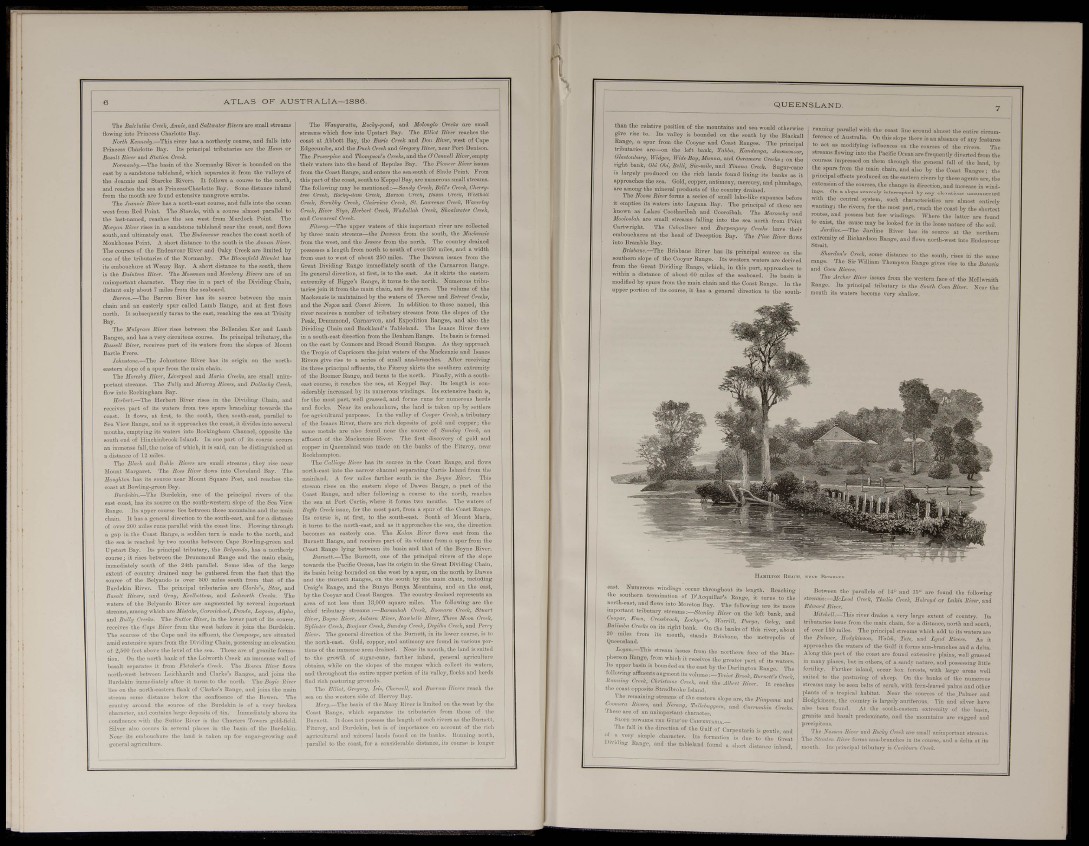
Eaj Rkacu, ;
east. Numerous windings occur throughout its length. Beaching
tho southei-n termination of D'Acquillar's Range, it turns to the
north-east, and flows into Moreton Bay. The following are its more
important tributary streams-.-Slanlcy Ri,rr on the left bank, and
too,jar. Emu, Cre.ssh-ook. Lockyer's, W„„iU, p^rgn, Oxlev, and
BMa Creek, on its right bank. On tho banks of this river, about
¿¡.er^kud
£r,3«„._This stream issues from the northei-n face of the Macpherson
Range, from which it receives the greater part of its watc.-s
J ts npper basin is bounded on tbe east by tho Darlington Range The
t.llowing affluents augment its volume -.-Teviaf. Brook, Bnr^ietfs Creek.
Rnmnng Creek, Chnsimm Craek, and the Alherf, River. It reaches
the coast opposite Stradbroke Island.
The remaining sti'eams of the eastern slope are, the Pi^tpama and
Genera Rivers, and Nerang, Tallebuggera, and Cun-uvMn Greeks.
I uese are of an unimportant character.
Swpz lOWARDS THE Gni,i"OV CAHI-ENTAIilA.
The fall in the direction of the Gnlf of Carpentaria is gentle and
? . character. Its forn.ation is due to the Great
IJ'vahng Rapge. „„d the tableland found a short dista7ice inland,
Between the parallels of 14" and are found the following
streams r—J/,-Li-orf Greek, Thalia 0,-eek, Bolroyd or LtiUn Rive,-, and
Edwnrtl River.
Mitchell.—This river drains a verj- large extent of country. Its
tributaries issue from the main chain, for a distance, north and south,
of over 150 miles. The principal sti'eams which add to its waters are
the Palmer, Sodgkinson, UaUh, Tale, and L>,,id Rivers. As it
approaches the waters of the Gulf it foms ana-branches and a delta.
Along this part of the coast are found extensive plains, well grassed
ni mauy places, but in others, of a sandy nature, and possessing little
fertility. Farther inland, occur bos forcsts, vrith large areas well
suited to the pasturing of sheep. On tho banks of the numerous
sti'eams may be seen belts of scrub, with fei-n-leaved palms and other
plants of a tropical habitat. Near the sources of the.Palmer and
Hodgkinson, the countij is largely auriferous. Tin and silver have
also been found. At the south-eastei-n extremity of the basiu,
granite and basalt predominate, and the mountains are rugged and
precipitous.
'I'he Nassau Rior and Rochj Creek are small nnimportant streams.
The Stauten River forms ana-branches in its coui-se, and a delta at its
mouth. Its iirincijial tributaiy is Carkburi, Creek.